Ust’-Karsk geodata
Ust’-Karsk (Transbaikal Territory) is a populated place; located in Russia in Asia/Chita (GMT+9) time zone. With population of 1,947 people, there are 4197 cities with bigger population in this country. Compared to other cities in Russia, 64.8% of cities are located further ↑North; 92.9% of cities are located further ←West and 88.1% of cities have lower elevation than Ust’-Karsk. Note1


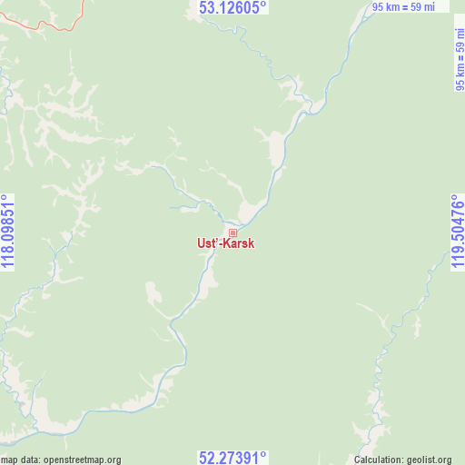
Ust’-Karsk GPS coordinates[2]
52° 42' 7.416" North, 118° 48' 5.868" East
| Map corner | latitude | longitude |
|---|---|---|
| Upper-left | 53.12605°, | 118.09851° |
| Center: | 52.70206°, | 118.80163° |
| Lower-right: | 52.27391°, | 119.50476° |
| Map W x H: | 94.7×94.7 km | = 58.8×58.8mi |
| max Lat: | 73.50819° ⇑64.8% North |
| Ust’-Karsk: | 52.70206° |
| min Lat: | ⇓35.2% South 41.28413° |
| min Long | Ust’-Karsk | max Long |
| -179.12198° | 118.80163° | 179.35046° |
| W 92.9%⇐ | ⇒7.1% E |
Elevation
Elevation of Ust’-Karsk is 399 m = 1309 ft, and this is 196.4 m = 644 ft above average elevation for this country.
| Max E: |
2518 m = 8261 ft | 11.9% |
| Ust’-Karsk | 399 m 1309 ft | |
| Avg. | 202.6 m = 665 ft | |
Min E: |
-28 m = -92 ft | 88.1% |
See also: Russia elevation on elevation.city.
Geographical zone
Ust’-Karsk is located in North temperate zone (between Tropic of Cancer and the Arctic Circle). Distance of this North polar circle is 1541.3 km =957.7 mi to North.| Distance of | km | miles | from Ust’-Karsk |
|---|---|---|---|
| North Pole | 4147.1 | 2576.9 | to North |
| Arctic Circle | 1541.3 | 957.7 | to North |
| Tropic Cancer | 3254 | 2021.9 | to South |
| Equator | 5859.9 | 3641.2 | to South |


Nearby cities:
15 places around Ust’-Karsk: (largest is in red/bold)
• Amazar
188.8 km =117.3 mi,  46°
46°
• Bukachacha
130.4 km =81 mi,  283°
283°
• Chernyshevsk
122.1 km =75.9 mi,  260°
260°
• Davenda
100.8 km =62.6 mi,  20°
20°
• Gazimurskiy Zavod
131.5 km =81.7 mi,  193°
193°
• Klyuchevskiy
102.2 km =63.5 mi,  25°
25°
• Kokuy
100.9 km =62.7 mi,  236°
236°
• Mogocha
131.5 km =81.7 mi, 29°
• Nerchinsk
170.6 km =106 mi, 242°
• Nerchinskiy Zavod
164.7 km =102.3 mi,  160°
160°
• Priiskovyy
170.4 km =105.9 mi, 239°
• Shelopugino
144 km =89.5 mi,  215°
215°
• Sretensk
89.6 km =55.7 mi, 235°
• Vershino-Shakhtaminskiy
168 km =104.4 mi,  201°
201°
• Zhireken
101.5 km =63.1 mi, 277°
Sources, notices
• [Note1] Compared only with cities in Russia existing in our database
• [Src1] Map data: © OpenStreetMap contributors (CC-BY-SA)
• [Src2] Other city data from geonames.org with taken over terms of usage.
• [Src3] Geographical zone / Annual Mean Temperature by Robert A. Rohde @ Wikipedia
