Chernyshevsk geodata
Chernyshevsk (Transbaikal Territory) is a populated place; located in Russia in Asia/Chita (GMT+9) time zone. With population of 12,466 people, there are 1235 cities with bigger population in this country. Compared to other cities in Russia, 66.1% of cities are located further ↑North; 92.6% of cities are located further ←West and 93% of cities have lower elevation than Chernyshevsk. Note1


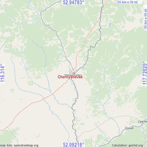
Chernyshevsk GPS coordinates[2]
52° 31' 19.524" North, 117° 1' 1.632" East
| Map corner | latitude | longitude |
|---|---|---|
| Upper-left | 52.94783°, | 116.314° |
| Center: | 52.52209°, | 117.01712° |
| Lower-right: | 52.09218°, | 117.72025° |
| Map W x H: | 95.1×95.1 km | = 59.1×59.1mi |
| max Lat: | 73.50819° ⇑66.1% North |
| Chernyshevsk: | 52.52209° |
| min Lat: | ⇓33.9% South 41.28413° |
| min Long | Chernyshevsk | max Long |
| -179.12198° | 117.01712° | 179.35046° |
| W 92.6%⇐ | ⇒7.4% E |
Elevation
Elevation of Chernyshevsk is 536 m = 1759 ft, and this is 333.4 m = 1094 ft above average elevation for this country.
| Max E: |
2518 m = 8261 ft | 7% |
| Chernyshevsk | 536 m 1759 ft | |
| Avg. | 202.6 m = 665 ft | |
Min E: |
-28 m = -92 ft | 93% |
See also: Russia elevation on elevation.city.
Geographical zone
Chernyshevsk is located in North temperate zone (between Tropic of Cancer and the Arctic Circle). Distance of this North polar circle is 1561.3 km =970.1 mi to North.| Distance of | km | miles | from Chernyshevsk |
|---|---|---|---|
| North Pole | 4167.2 | 2589.4 | to North |
| Arctic Circle | 1561.3 | 970.1 | to North |
| Tropic Cancer | 3234 | 2009.5 | to South |
| Equator | 5839.9 | 3628.7 | to South |


Nearby cities:
15 places around Chernyshevsk: (largest is in red/bold)
• Arbagar
83.8 km =52.1 mi,  218°
218°
• Baley
107.8 km =67 mi,  194°
194°
• Bukachacha
51.7 km =32.1 mi,  352°
352°
• Kholbon
88.2 km =54.8 mi, 216°
• Kokuy
50.6 km =31.4 mi,  133°
133°
• Nerchinsk
66.8 km =41.5 mi,  206°
206°
• Pervomayskiy
134.2 km =83.4 mi,  225°
225°
• Priiskovyy
70.5 km =43.8 mi,  201°
201°
• Shelopugino
103.6 km =64.4 mi,  158°
158°
• Shilka
100.4 km =62.4 mi, 221°
• Sretensk
56 km =34.8 mi,  123°
123°
• Ust’-Karsk
122.1 km =75.9 mi,  80°
80°
• Verkh-Usugli
126.5 km =78.6 mi,  278°
278°
• Vershino-Darasunskiy
102.5 km =63.7 mi,  260°
260°
• Zhireken
39.1 km =24.3 mi,  30°
30°
Sources, notices
• [Note1] Compared only with cities in Russia existing in our database
• [Src1] Map data: © OpenStreetMap contributors (CC-BY-SA)
• [Src2] Other city data from geonames.org with taken over terms of usage.
• [Src3] Geographical zone / Annual Mean Temperature by Robert A. Rohde @ Wikipedia
