Magdagachi geodata
Magdagachi (Amur Oblast) is a populated place; located in Russia in Asia/Yakutsk (GMT+9) time zone. With population of 11,739 people, there are 1303 cities with bigger population in this country. Compared to other cities in Russia, 59% of cities are located further ↑North; 93.6% of cities are located further ←West and 86.6% of cities have lower elevation than Magdagachi. Note1


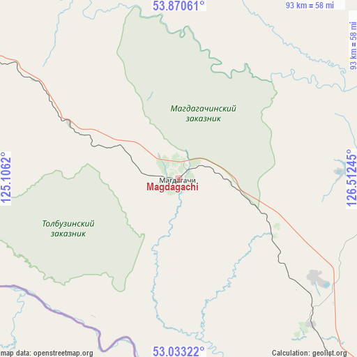
Magdagachi GPS coordinates[2]
53° 27' 14.328" North, 125° 48' 33.552" East
| Map corner | latitude | longitude |
|---|---|---|
| Upper-left | 53.87061°, | 125.1062° |
| Center: | 53.45398°, | 125.80932° |
| Lower-right: | 53.03322°, | 126.51245° |
| Map W x H: | 93.1×93.1 km | = 57.8×57.8mi |
| max Lat: | 73.50819° ⇑59% North |
| Magdagachi: | 53.45398° |
| min Lat: | ⇓41% South 41.28413° |
| min Long | Magdagachi | max Long |
| -179.12198° | 125.80932° | 179.35046° |
| W 93.6%⇐ | ⇒6.4% E |
Elevation
Elevation of Magdagachi is 356 m = 1168 ft, and this is 153.4 m = 503 ft above average elevation for this country.
| Max E: |
2518 m = 8261 ft | 13.4% |
| Magdagachi | 356 m 1168 ft | |
| Avg. | 202.6 m = 665 ft | |
Min E: |
-28 m = -92 ft | 86.6% |
See also: Russia elevation on elevation.city.
Geographical zone
Magdagachi is located in North temperate zone (between Tropic of Cancer and the Arctic Circle). Distance of this North polar circle is 1457.6 km =905.7 mi to North.| Distance of | km | miles | from Magdagachi |
|---|---|---|---|
| North Pole | 4063.5 | 2524.9 | to North |
| Arctic Circle | 1457.6 | 905.7 | to North |
| Tropic Cancer | 3337.6 | 2073.9 | to South |
| Equator | 5943.5 | 3693.1 | to South |


Nearby cities:
15 places around Magdagachi: (largest is in red/bold)
• Never
123.4 km =76.7 mi,  298°
298°
• Ovsyanka
73.2 km =45.5 mi,  79°
79°
• Shimanovsk
204.3 km =126.9 mi,  142°
142°
• Sivaki
110.6 km =68.7 mi,  145°
145°
• Skovorodino
136.4 km =84.8 mi, 295°
• Solovjevsk
125.1 km =77.7 mi,  313°
313°
• Takhtamygda
162 km =100.7 mi, 296°
• Taldan
70.7 km =43.9 mi,  291°
291°
• Tsiolkovskiy
243.7 km =151.4 mi, 140°
• Tygda
51.4 km =31.9 mi, 137°
• Tynda
201.9 km =125.5 mi,  339°
339°
• Urusha
203.4 km =126.4 mi, 289°
• Ushumun
88.7 km =55.1 mi, 146°
• Yerofey Pavlovich
259.7 km =161.4 mi,  282°
282°
• Zeya
100.5 km =62.4 mi,  71°
71°
Sources, notices
• [Note1] Compared only with cities in Russia existing in our database
• [Src1] Map data: © OpenStreetMap contributors (CC-BY-SA)
• [Src2] Other city data from geonames.org with taken over terms of usage.
• [Src3] Geographical zone / Annual Mean Temperature by Robert A. Rohde @ Wikipedia
