Tygda geodata
Tygda (Amur Oblast) is a populated place; located in Russia in Asia/Yakutsk (GMT+9) time zone. With population of 3,510 people, there are 3391 cities with bigger population in this country. Compared to other cities in Russia, 62.2% of cities are located further ↑North; 93.6% of cities are located further ←West and 84.7% of cities have lower elevation than Tygda. Note1


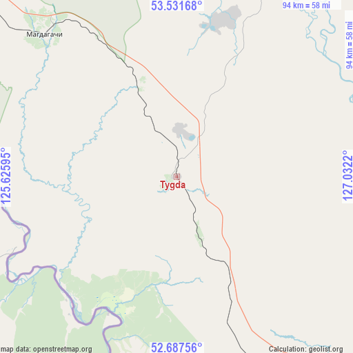
Tygda GPS coordinates[2]
53° 6' 42.084" North, 126° 19' 44.652" East
| Map corner | latitude | longitude |
|---|---|---|
| Upper-left | 53.53168°, | 125.62595° |
| Center: | 53.11169°, | 126.32907° |
| Lower-right: | 52.68756°, | 127.0322° |
| Map W x H: | 93.9×93.9 km | = 58.3×58.3mi |
| max Lat: | 73.50819° ⇑62.2% North |
| Tygda: | 53.11169° |
| min Lat: | ⇓37.8% South 41.28413° |
| min Long | Tygda | max Long |
| -179.12198° | 126.32907° | 179.35046° |
| W 93.6%⇐ | ⇒6.4% E |
Elevation
Elevation of Tygda is 315 m = 1033 ft, and this is 112.4 m = 369 ft above average elevation for this country.
| Max E: |
2518 m = 8261 ft | 15.3% |
| Tygda | 315 m 1033 ft | |
| Avg. | 202.6 m = 665 ft | |
Min E: |
-28 m = -92 ft | 84.7% |
See also: Russia elevation on elevation.city.
Geographical zone
Tygda is located in North temperate zone (between Tropic of Cancer and the Arctic Circle). Distance of this North polar circle is 1495.7 km =929.4 mi to North.| Distance of | km | miles | from Tygda |
|---|---|---|---|
| North Pole | 4101.6 | 2548.6 | to North |
| Arctic Circle | 1495.7 | 929.4 | to North |
| Tropic Cancer | 3299.5 | 2050.2 | to South |
| Equator | 5905.5 | 3669.5 | to South |


Nearby cities:
15 places around Tygda: (largest is in red/bold)
• Magdagachi
51.4 km =31.9 mi,  317°
317°
• Never
172.9 km =107.4 mi,  303°
303°
• Ovsyanka
64.1 km =39.8 mi,  35°
35°
• Shimanovsk
153.1 km =95.1 mi,  143°
143°
• Sivaki
60.1 km =37.3 mi,  152°
152°
• Skovorodino
185.3 km =115.1 mi, 301°
• Solovjevsk
176.5 km =109.7 mi,  314°
314°
• Svobodnyy
229.1 km =142.4 mi, 147°
• Takhtamygda
211 km =131.1 mi, 301°
• Taldan
119.2 km =74.1 mi, 302°
• Tsiolkovskiy
192.4 km =119.6 mi, 141°
• Tynda
250.2 km =155.5 mi,  335°
335°
• Urusha
250.2 km =155.5 mi,  294°
294°
• Ushumun
38.8 km =24.1 mi,  158°
158°
• Zeya
92.7 km =57.6 mi, 41°
Sources, notices
• [Note1] Compared only with cities in Russia existing in our database
• [Src1] Map data: © OpenStreetMap contributors (CC-BY-SA)
• [Src2] Other city data from geonames.org with taken over terms of usage.
• [Src3] Geographical zone / Annual Mean Temperature by Robert A. Rohde @ Wikipedia
