Kyren geodata
Kyren (Buryatiya Republic) is a populated place; located in Russia in Asia/Irkutsk (GMT+8) time zone. With population of 5,334 people, there are 2496 cities with bigger population in this country. Compared to other cities in Russia, 71.3% of cities are located further ↑North; 88.6% of cities are located further ←West and 96.8% of cities have lower elevation than Kyren. Note1


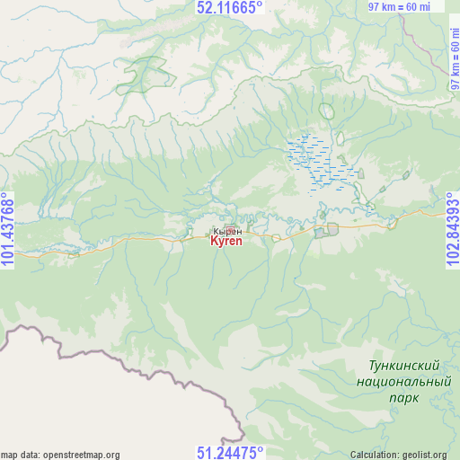
Kyren GPS coordinates[2]
51° 40' 58.08" North, 102° 8' 26.88" East
| Map corner | latitude | longitude |
|---|---|---|
| Upper-left | 52.11665°, | 101.43768° |
| Center: | 51.6828°, | 102.1408° |
| Lower-right: | 51.24475°, | 102.84393° |
| Map W x H: | 96.9×96.9 km | = 60.2×60.2mi |
| max Lat: | 73.50819° ⇑71.3% North |
| Kyren: | 51.6828° |
| min Lat: | ⇓28.7% South 41.28413° |
| min Long | Kyren | max Long |
| -179.12198° | 102.1408° | 179.35046° |
| W 88.6%⇐ | ⇒11.4% E |
Elevation
Elevation of Kyren is 751 m = 2464 ft, and this is 548.4 m = 1799 ft above average elevation for this country.
| Max E: |
2518 m = 8261 ft | 3.2% |
| Kyren | 751 m 2464 ft | |
| Avg. | 202.6 m = 665 ft | |
Min E: |
-28 m = -92 ft | 96.8% |
See also: Russia elevation on elevation.city.
Geographical zone
Kyren is located in North temperate zone (between Tropic of Cancer and the Arctic Circle). Distance of this North polar circle is 1654.6 km =1028.1 mi to North.| Distance of | km | miles | from Kyren |
|---|---|---|---|
| North Pole | 4260.5 | 2647.4 | to North |
| Arctic Circle | 1654.6 | 1028.1 | to North |
| Tropic Cancer | 3140.7 | 1951.5 | to South |
| Equator | 5746.6 | 3570.8 | to South |


Nearby cities:
15 places around Kyren: (largest is in red/bold)
• Angarsk
152.4 km =94.7 mi,  51°
51°
• Baklashi
144 km =89.5 mi,  65°
65°
• Bayangol
143.2 km =89 mi,  139°
139°
• Baykal’sk
139.3 km =86.6 mi,  97°
97°
• Chistyye Klyuchi
135.7 km =84.3 mi, 65°
• Kultuk
107.2 km =66.6 mi,  87°
87°
• Mishelevka
148.3 km =92.1 mi,  28°
28°
• Moty
128.4 km =79.8 mi, 70°
• Shamanka
122.9 km =76.4 mi, 69°
• Shelekhov
146.7 km =91.2 mi, 66°
• Slyudyanka
108 km =67.1 mi, 91°
• Smolenshchina
150.3 km =93.4 mi,  64°
64°
• Utulik
133.2 km =82.8 mi, 96°
• Vvedenshchina
136.6 km =84.9 mi, 64°
• Zhemchug
21.9 km =13.6 mi, 89°
Sources, notices
• [Note1] Compared only with cities in Russia existing in our database
• [Src1] Map data: © OpenStreetMap contributors (CC-BY-SA)
• [Src2] Other city data from geonames.org with taken over terms of usage.
• [Src3] Geographical zone / Annual Mean Temperature by Robert A. Rohde @ Wikipedia
