Baykal’sk geodata
Baykal’sk (Irkutsk Oblast) is a populated place; located in Russia in Asia/Irkutsk (GMT+8) time zone. With population of 15,600 people, there are 1057 cities with bigger population in this country. Compared to other cities in Russia, 72.5% of cities are located further ↑North; 89.5% of cities are located further ←West and 91.7% of cities have lower elevation than Baykal’sk. Note1


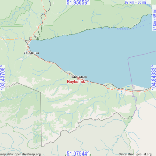
Baykal’sk GPS coordinates[2]
51° 30' 54.36" North, 104° 8' 24.72" East
| Map corner | latitude | longitude |
|---|---|---|
| Upper-left | 51.95056°, | 103.43708° |
| Center: | 51.5151°, | 104.1402° |
| Lower-right: | 51.07544°, | 104.84333° |
| Map W x H: | 97.3×97.3 km | = 60.5×60.5mi |
| max Lat: | 73.50819° ⇑72.5% North |
| Baykal’sk: | 51.5151° |
| min Lat: | ⇓27.5% South 41.28413° |
| min Long | Baykal’sk | max Long |
| -179.12198° | 104.1402° | 179.35046° |
| W 89.5%⇐ | ⇒10.5% E |
Elevation
Elevation of Baykal’sk is 495 m = 1624 ft, and this is 292.4 m = 959 ft above average elevation for this country.
| Max E: |
2518 m = 8261 ft | 8.3% |
| Baykal’sk | 495 m 1624 ft | |
| Avg. | 202.6 m = 665 ft | |
Min E: |
-28 m = -92 ft | 91.7% |
See also: Russia elevation on elevation.city.
Geographical zone
Baykal’sk is located in North temperate zone (between Tropic of Cancer and the Arctic Circle). Distance of this North polar circle is 1673.2 km =1039.7 mi to North.| Distance of | km | miles | from Baykal’sk |
|---|---|---|---|
| North Pole | 4279.1 | 2658.9 | to North |
| Arctic Circle | 1673.2 | 1039.7 | to North |
| Tropic Cancer | 3122 | 1939.9 | to South |
| Equator | 5727.9 | 3559.2 | to South |


Nearby cities:
15 places around Baykal’sk: (largest is in red/bold)
• Bol’shaya Rechka
63.6 km =39.5 mi,  39°
39°
• Chistyye Klyuchi
75.1 km =46.7 mi,  349°
349°
• Kultuk
38.3 km =23.8 mi,  306°
306°
• Listvyanka
62.8 km =39 mi,  53°
53°
• Markova
77.3 km =48 mi,  3°
3°
• Moty
64.4 km =40 mi, 345°
• Pad’ Mel’nichnaya
73.6 km =45.7 mi,  12°
12°
• Rechka-Vydrino
48.7 km =30.3 mi,  93°
93°
• Shamanka
65.2 km =40.5 mi,  340°
340°
• Shelekhov
77.7 km =48.3 mi,  357°
357°
• Slyudyanka
34 km =21.1 mi,  298°
298°
• Tankhoy
68.4 km =42.5 mi, 86°
• Utulik
6.7 km =4.2 mi, 301°
• Vvedenshchina
78.1 km =48.5 mi, 350°
• Vydrino
35.3 km =21.9 mi,  99°
99°
Sources, notices
• [Note1] Compared only with cities in Russia existing in our database
• [Src1] Map data: © OpenStreetMap contributors (CC-BY-SA)
• [Src2] Other city data from geonames.org with taken over terms of usage.
• [Src3] Geographical zone / Annual Mean Temperature by Robert A. Rohde @ Wikipedia
