Sinda geodata
Sinda (Khabarovsk) is a populated place; located in Russia in Asia/Vladivostok (GMT+10) time zone. With population of 867 people, there are 4722 cities with bigger population in this country. Compared to other cities in Russia, 79.2% of cities are located further ↑North; 97.3% of cities are located further ←West and 87% of cities have higher elevation than Sinda. Note1


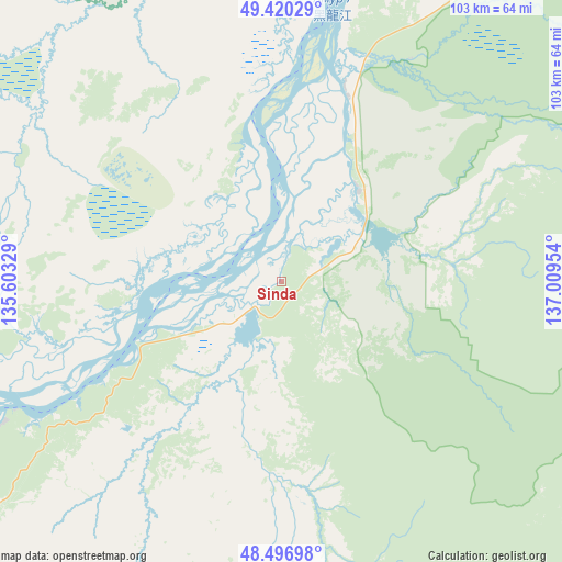
Sinda GPS coordinates[2]
48° 57' 38.772" North, 136° 18' 23.076" East
| Map corner | latitude | longitude |
|---|---|---|
| Upper-left | 49.42029°, | 135.60329° |
| Center: | 48.96077°, | 136.30641° |
| Lower-right: | 48.49698°, | 137.00954° |
| Map W x H: | 102.7×102.7 km | = 63.8×63.8mi |
| max Lat: | 73.50819° ⇑79.2% North |
| Sinda: | 48.96077° |
| min Lat: | ⇓20.8% South 41.28413° |
| min Long | Sinda | max Long |
| -179.12198° | 136.30641° | 179.35046° |
| W 97.3%⇐ | ⇒2.7% E |
Elevation
Elevation of Sinda is 40 m = 131 ft, and this is 162.6 m = 533 ft below average elevation for this country.
| Max E: |
2518 m = 8261 ft | 87% |
| Avg. | 202.6 m = 665 ft | |
| Sinda | 40 m = 131 ft | |
Min E: |
-28 m = -92 ft | 13% |
See also: Russia elevation on elevation.city.
Geographical zone
Sinda is located in North temperate zone (between Tropic of Cancer and the Arctic Circle). Distance of this North polar circle is 1957.2 km =1216.1 mi to North.| Distance of | km | miles | from Sinda |
|---|---|---|---|
| North Pole | 4563.1 | 2835.4 | to North |
| Arctic Circle | 1957.2 | 1216.1 | to North |
| Tropic Cancer | 2838 | 1763.5 | to South |
| Equator | 5443.9 | 3382.7 | to South |


Nearby cities:
15 places around Sinda: (largest is in red/bold)
• Amursk
147.8 km =91.8 mi,  16°
16°
• Khabarovsk
104.3 km =64.8 mi,  239°
239°
• Khabarovsk Vtoroy
103.9 km =64.6 mi, 235°
• Khor
156 km =96.9 mi,  220°
220°
• Khurba
166 km =103.1 mi,  14°
14°
• Knyaze-Volkonskoye
83.2 km =51.7 mi,  228°
228°
• Komsomolsk-on-Amur
183.8 km =114.2 mi, 15°
• Korfovskiy
123.1 km =76.5 mi, 228°
• Litovko
88 km =54.7 mi,  290°
290°
• Mukhen
86 km =53.4 mi,  188°
188°
• Nekrasovka
103.9 km =64.6 mi, 229°
• Priamurskiy
113.6 km =70.6 mi, 244°
• Selikhino
178.6 km =111 mi,  28°
28°
• Topolëvo
97.3 km =60.5 mi, 238°
• Volochayevka Vtoraya
133.7 km =83.1 mi,  250°
250°
Sources, notices
• [Note1] Compared only with cities in Russia existing in our database
• [Src1] Map data: © OpenStreetMap contributors (CC-BY-SA)
• [Src2] Other city data from geonames.org with taken over terms of usage.
• [Src3] Geographical zone / Annual Mean Temperature by Robert A. Rohde @ Wikipedia
