Gashey geodata
Gashey (Buryatiya Republic) is a populated place; located in Russia in Asia/Irkutsk (GMT+8) time zone. With population of 550 people, there are 4931 cities with bigger population in this country. Compared to other cities in Russia, 74.7% of cities are located further ↑North; 90.4% of cities are located further ←West and 94.3% of cities have lower elevation than Gashey. Note1


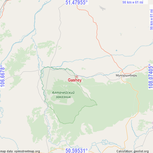
Gashey GPS coordinates[2]
51° 2' 22.344" North, 107° 22' 15.312" East
| Map corner | latitude | longitude |
|---|---|---|
| Upper-left | 51.47955°, | 106.6678° |
| Center: | 51.03954°, | 107.37092° |
| Lower-right: | 50.59531°, | 108.07405° |
| Map W x H: | 98.3×98.3 km | = 61.1×61.1mi |
| max Lat: | 73.50819° ⇑74.7% North |
| Gashey: | 51.03954° |
| min Lat: | ⇓25.3% South 41.28413° |
| min Long | Gashey | max Long |
| -179.12198° | 107.37092° | 179.35046° |
| W 90.4%⇐ | ⇒9.6% E |
Elevation
Elevation of Gashey is 598 m = 1962 ft, and this is 395.4 m = 1297 ft above average elevation for this country.
| Max E: |
2518 m = 8261 ft | 5.7% |
| Gashey | 598 m 1962 ft | |
| Avg. | 202.6 m = 665 ft | |
Min E: |
-28 m = -92 ft | 94.3% |
See also: Russia elevation on elevation.city.
Geographical zone
Gashey is located in North temperate zone (between Tropic of Cancer and the Arctic Circle). Distance of this North polar circle is 1726.1 km =1072.5 mi to North.| Distance of | km | miles | from Gashey |
|---|---|---|---|
| North Pole | 4332 | 2691.8 | to North |
| Arctic Circle | 1726.1 | 1072.5 | to North |
| Tropic Cancer | 3069.1 | 1907 | to South |
| Equator | 5675.1 | 3526.3 | to South |


Nearby cities:
15 places around Gashey: (largest is in red/bold)
• Bichura
52.8 km =32.8 mi,  162°
162°
• Bol’shoy Kunaley
46.7 km =29 mi,  20°
20°
• Gusinoozyorsk
66.5 km =41.3 mi,  294°
294°
• Gusinoye Ozero
78 km =48.5 mi,  276°
276°
• Ivolginsk
79.1 km =49.2 mi,  355°
355°
• Khonkholoy
60.5 km =37.6 mi,  80°
80°
• Mukhorshibir’
32.1 km =19.9 mi,  87°
87°
• Nikolayevskiy
74.7 km =46.4 mi, 23°
• Nikol’sk
68.4 km =42.5 mi, 75°
• Nizhniy Sayantuy
78.2 km =48.6 mi,  7°
7°
• Novosretenka
42 km =26.1 mi,  148°
148°
• Novyy Zagan
27.5 km =17.1 mi, 92°
• Okino-Klyuchi
52.8 km =32.8 mi,  200°
200°
• Sharalday
19.2 km =11.9 mi, 94°
• Tarbagatay
49.2 km =30.6 mi, 359°
Sources, notices
• [Note1] Compared only with cities in Russia existing in our database
• [Src1] Map data: © OpenStreetMap contributors (CC-BY-SA)
• [Src2] Other city data from geonames.org with taken over terms of usage.
• [Src3] Geographical zone / Annual Mean Temperature by Robert A. Rohde @ Wikipedia
