Gusinoozyorsk geodata
Gusinoozyorsk (Buryatiya Republic) is a populated place; located in Russia in Asia/Irkutsk (GMT+8) time zone. With population of 24,083 people, there are 767 cities with bigger population in this country. Compared to other cities in Russia, 73.6% of cities are located further ↑North; 90.2% of cities are located further ←West and 93.2% of cities have lower elevation than Gusinoozyorsk. Note1


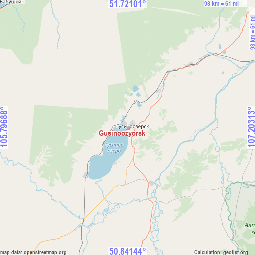
Gusinoozyorsk GPS coordinates[2]
51° 16' 59.988" North, 106° 30' 0" East
| Map corner | latitude | longitude |
|---|---|---|
| Upper-left | 51.72101°, | 105.79688° |
| Center: | 51.28333°, | 106.5° |
| Lower-right: | 50.84144°, | 107.20313° |
| Map W x H: | 97.8×97.8 km | = 60.8×60.8mi |
| max Lat: | 73.50819° ⇑73.6% North |
| Gusinoozyorsk: | 51.28333° |
| min Lat: | ⇓26.4% South 41.28413° |
| min Long | Gusinoozyorsk | max Long |
| -179.12198° | 106.5° | 179.35046° |
| W 90.2%⇐ | ⇒9.8% E |
Elevation
Elevation of Gusinoozyorsk is 548 m = 1798 ft, and this is 345.4 m = 1133 ft above average elevation for this country.
| Max E: |
2518 m = 8261 ft | 6.8% |
| Gusinoozyorsk | 548 m 1798 ft | |
| Avg. | 202.6 m = 665 ft | |
Min E: |
-28 m = -92 ft | 93.2% |
See also: Russia elevation on elevation.city.
Geographical zone
Gusinoozyorsk is located in North temperate zone (between Tropic of Cancer and the Arctic Circle). Distance of this North polar circle is 1699 km =1055.7 mi to North.| Distance of | km | miles | from Gusinoozyorsk |
|---|---|---|---|
| North Pole | 4304.9 | 2674.9 | to North |
| Arctic Circle | 1699 | 1055.7 | to North |
| Tropic Cancer | 3096.3 | 1924 | to South |
| Equator | 5702.2 | 3543.2 | to South |


Nearby cities:
15 places around Gusinoozyorsk: (largest is in red/bold)
• Babushkin
64.9 km =40.3 mi,  317°
317°
• Bol’shoy Kunaley
78.7 km =48.9 mi,  77°
77°
• Dzhida
71 km =44.1 mi,  198°
198°
• Gashey
66.5 km =41.3 mi,  114°
114°
• Gusinoye Ozero
25.1 km =15.6 mi,  221°
221°
• Ivolginsk
75 km =46.6 mi,  46°
46°
• Kabansk
85.7 km =53.3 mi,  7°
7°
• Nizhniy Sayantuy
86.4 km =53.7 mi, 54°
• Okino-Klyuchi
87.7 km =54.5 mi,  150°
150°
• Posol’skoye
85 km =52.8 mi,  344°
344°
• Selenduma
45 km =28 mi, 203°
• Sharalday
84.8 km =52.7 mi, 109°
• Sokol
87 km =54.1 mi, 48°
• Tarbagatay
63.7 km =39.6 mi,  69°
69°
• Verkhnyaya Ivolga
70.9 km =44.1 mi,  42°
42°
Sources, notices
• [Note1] Compared only with cities in Russia existing in our database
• [Src1] Map data: © OpenStreetMap contributors (CC-BY-SA)
• [Src2] Other city data from geonames.org with taken over terms of usage.
• [Src3] Geographical zone / Annual Mean Temperature by Robert A. Rohde @ Wikipedia
