Okha geodata
Okha (Sakhalin Oblast) is a populated place; located in Russia in Asia/Sakhalin (GMT+11) time zone. With population of 26,560 people, there are 726 cities with bigger population in this country. Compared to other cities in Russia, 58.2% of cities are located further ↑North; 98.6% of cities are located further ←West and 92.5% of cities have higher elevation than Okha. Note1


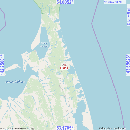
Okha GPS coordinates[2]
53° 35' 23.676" North, 142° 57' 11.268" East
| Map corner | latitude | longitude |
|---|---|---|
| Upper-left | 54.0052°, | 142.25001° |
| Center: | 53.58991°, | 142.95313° |
| Lower-right: | 53.1705°, | 143.65626° |
| Map W x H: | 92.8×92.8 km | = 57.7×57.7mi |
| max Lat: | 73.50819° ⇑58.2% North |
| Okha: | 53.58991° |
| min Lat: | ⇓41.8% South 41.28413° |
| min Long | Okha | max Long |
| -179.12198° | 142.95313° | 179.35046° |
| W 98.6%⇐ | ⇒1.4% E |
Elevation
Elevation of Okha is 20 m = 66 ft, and this is 182.6 m = 599 ft below average elevation for this country.
| Max E: |
2518 m = 8261 ft | 92.5% |
| Avg. | 202.6 m = 665 ft | |
| Okha | 20 m = 66 ft | |
Min E: |
-28 m = -92 ft | 7.5% |
See also: Russia elevation on elevation.city.
Geographical zone
Okha is located in North temperate zone (between Tropic of Cancer and the Arctic Circle). Distance of this North polar circle is 1442.5 km =896.3 mi to North.| Distance of | km | miles | from Okha |
|---|---|---|---|
| North Pole | 4048.4 | 2515.6 | to North |
| Arctic Circle | 1442.5 | 896.3 | to North |
| Tropic Cancer | 3352.7 | 2083.3 | to South |
| Equator | 5958.6 | 3702.5 | to South |


Nearby cities:
15 places around Okha: (largest is in red/bold)
• Aleksandrovsk-Sakhalinskiy
304 km =188.9 mi,  190°
190°
• Bogorodskoye
216 km =134.2 mi,  231°
231°
• De-Kastri
277.6 km =172.5 mi,  212°
212°
• Ekhabi
8.8 km =5.5 mi,  173°
173°
• Katangli
209 km =129.9 mi, 174°
• Lazarev
180.1 km =111.9 mi, 212°
• Mago
187.2 km =116.3 mi,  258°
258°
• Mgachi
286.4 km =178 mi, 189°
• Mnogovershinnyy
202.5 km =125.8 mi,  280°
280°
• Nikolayevsk-on-Amure
156 km =96.9 mi,  251°
251°
• Nogliki
199.5 km =124 mi,  176°
176°
• Smirnykh
427.5 km =265.6 mi, 181°
• Tungor
22.1 km =13.7 mi, 179°
• Tymovskoye
305.4 km =189.8 mi, 183°
• Val
139.4 km =86.6 mi, 176°
Sources, notices
• [Note1] Compared only with cities in Russia existing in our database
• [Src1] Map data: © OpenStreetMap contributors (CC-BY-SA)
• [Src2] Other city data from geonames.org with taken over terms of usage.
• [Src3] Geographical zone / Annual Mean Temperature by Robert A. Rohde @ Wikipedia
