Lazarev geodata
Lazarev (Khabarovsk) is a populated place; located in Russia in Asia/Vladivostok (GMT+10) time zone. With population of 1,906 people, there are 4216 cities with bigger population in this country. Compared to other cities in Russia, 67.8% of cities are located further ↑North; 97.9% of cities are located further ←West and 94.5% of cities have higher elevation than Lazarev. Note1


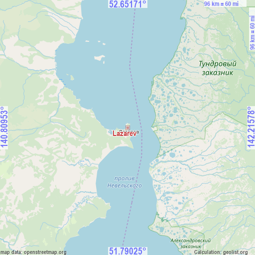
Lazarev GPS coordinates[2]
52° 13' 23.052" North, 141° 30' 45.54" East
| Map corner | latitude | longitude |
|---|---|---|
| Upper-left | 52.65171°, | 140.80953° |
| Center: | 52.22307°, | 141.51265° |
| Lower-right: | 51.79025°, | 142.21578° |
| Map W x H: | 95.8×95.8 km | = 59.5×59.5mi |
| max Lat: | 73.50819° ⇑67.8% North |
| Lazarev: | 52.22307° |
| min Lat: | ⇓32.2% South 41.28413° |
| min Long | Lazarev | max Long |
| -179.12198° | 141.51265° | 179.35046° |
| W 97.9%⇐ | ⇒2.1% E |
Elevation
Elevation of Lazarev is 14 m = 46 ft, and this is 188.6 m = 619 ft below average elevation for this country.
| Max E: |
2518 m = 8261 ft | 94.5% |
| Avg. | 202.6 m = 665 ft | |
| Lazarev | 14 m = 46 ft | |
Min E: |
-28 m = -92 ft | 5.5% |
See also: Russia elevation on elevation.city.
Geographical zone
Lazarev is located in North temperate zone (between Tropic of Cancer and the Arctic Circle). Distance of this North polar circle is 1594.5 km =990.8 mi to North.| Distance of | km | miles | from Lazarev |
|---|---|---|---|
| North Pole | 4200.4 | 2610 | to North |
| Arctic Circle | 1594.5 | 990.8 | to North |
| Tropic Cancer | 3200.7 | 1988.8 | to South |
| Equator | 5806.7 | 3608.1 | to South |


Nearby cities:
15 places around Lazarev: (largest is in red/bold)
• Aleksandrovsk-Sakhalinskiy
153.9 km =95.6 mi,  163°
163°
• Bogorodskoye
75.1 km =46.7 mi,  282°
282°
• De-Kastri
97.5 km =60.6 mi,  211°
211°
• Ekhabi
173.4 km =107.7 mi,  34°
34°
• Katangli
130 km =80.8 mi,  115°
115°
• Mago
145.8 km =90.6 mi,  322°
322°
• Mgachi
140.6 km =87.4 mi, 158°
• Mnogovershinnyy
217.7 km =135.3 mi,  330°
330°
• Nikolayevsk-on-Amure
115.7 km =71.9 mi, 332°
• Nogliki
120.9 km =75.1 mi,  112°
112°
• Okha
180.1 km =111.9 mi, 32°
• Tsimmermanovka
183.9 km =114.3 mi,  237°
237°
• Tungor
162.2 km =100.8 mi,  36°
36°
• Tymovskoye
172.3 km =107.1 mi,  152°
152°
• Val
106.3 km =66.1 mi,  83°
83°
Sources, notices
• [Note1] Compared only with cities in Russia existing in our database
• [Src1] Map data: © OpenStreetMap contributors (CC-BY-SA)
• [Src2] Other city data from geonames.org with taken over terms of usage.
• [Src3] Geographical zone / Annual Mean Temperature by Robert A. Rohde @ Wikipedia
