Zhiryatino geodata
Zhiryatino (Bryansk Oblast) is a populated place; located in Russia in Europe/Moscow (GMT+3) time zone. With population of 2,324 people, there are 4027 cities with bigger population in this country. Compared to other cities in Russia, 61.2% of cities are located further ↑North; 90.8% of cities are located further →East and 64.3% of cities have lower elevation than Zhiryatino. Note1


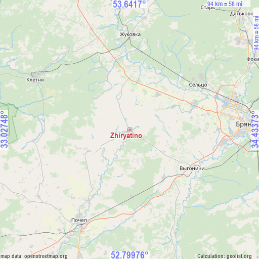
Zhiryatino GPS coordinates[2]
53° 13' 22.08" North, 33° 43' 50.16" East
| Map corner | latitude | longitude |
|---|---|---|
| Upper-left | 53.6417°, | 33.02748° |
| Center: | 53.2228°, | 33.7306° |
| Lower-right: | 52.79976°, | 34.43373° |
| Map W x H: | 93.6×93.6 km | = 58.2×58.2mi |
| max Lat: | 73.50819° ⇑61.2% North |
| Zhiryatino: | 53.2228° |
| min Lat: | ⇓38.8% South 41.28413° |
| min Long | Zhiryatino | max Long |
| -179.12198° | 33.7306° | 179.35046° |
| W 9.2%⇐ | ⇒90.8% E |
Elevation
Elevation of Zhiryatino is 180 m = 591 ft, and this is 22.6 m = 74 ft below average elevation for this country.
| Max E: |
2518 m = 8261 ft | 35.7% |
| Avg. | 202.6 m = 665 ft | |
| Zhiryatino | 180 m = 591 ft | |
Min E: |
-28 m = -92 ft | 64.3% |
See also: Russia elevation on elevation.city.
Geographical zone
Zhiryatino is located in North temperate zone (between Tropic of Cancer and the Arctic Circle). Distance of this North polar circle is 1483.4 km =921.7 mi to North.| Distance of | km | miles | from Zhiryatino |
|---|---|---|---|
| North Pole | 4089.2 | 2540.9 | to North |
| Arctic Circle | 1483.4 | 921.7 | to North |
| Tropic Cancer | 3311.9 | 2057.9 | to South |
| Equator | 5917.8 | 3677.1 | to South |


Nearby cities:
15 places around Zhiryatino: (largest is in red/bold)
• Bryansk
42.8 km =26.6 mi,  85°
85°
• Dobrun’
34.6 km =21.5 mi,  96°
96°
• Glinishchevo
24 km =14.9 mi,  67°
67°
• Ivanovka
35.3 km =21.9 mi, 66°
• Kletnya
38.8 km =24.1 mi,  298°
298°
• Net’inka
33.6 km =20.9 mi, 65°
• Ovstug
18.7 km =11.6 mi,  30°
30°
• Pochep
37.3 km =23.2 mi,  210°
210°
• Putëvka
37.3 km =23.2 mi,  83°
83°
• Raditsa-Krylovka
43 km =26.7 mi, 75°
• Rzhanitsa
26.2 km =16.3 mi, 29°
• Sel’tso
29.6 km =18.4 mi,  56°
56°
• Suponevo
37.7 km =23.4 mi, 93°
• Vygonichi
26.4 km =16.4 mi,  121°
121°
• Zhukovka
34.6 km =21.5 mi,  359°
359°
Sources, notices
• [Note1] Compared only with cities in Russia existing in our database
• [Src1] Map data: © OpenStreetMap contributors (CC-BY-SA)
• [Src2] Other city data from geonames.org with taken over terms of usage.
• [Src3] Geographical zone / Annual Mean Temperature by Robert A. Rohde @ Wikipedia
