Yur’yev-Pol’skiy geodata
Yur’yev-Pol’skiy (Vladimir) is a populated place; located in Russia in Europe/Moscow (GMT+3) time zone. With population of 19,906 people, there are 875 cities with bigger population in this country. Compared to other cities in Russia, 72.8% of cities are located further ↓South; 69.2% of cities are located further →East and 53.1% of cities have higher elevation than Yur’yev-Pol’skiy. Note1


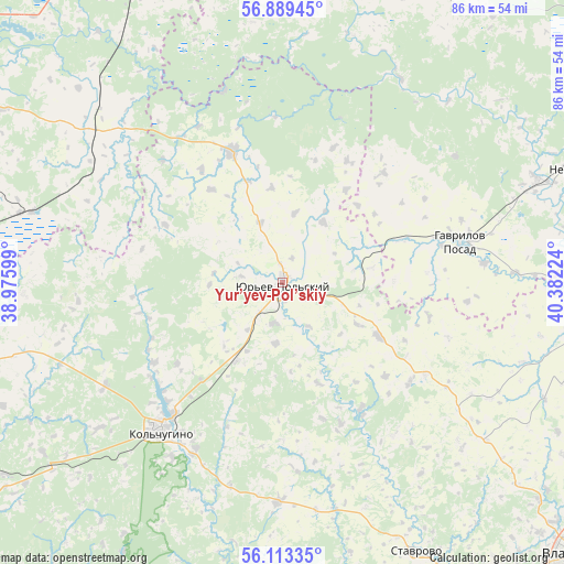
Yur’yev-Pol’skiy GPS coordinates[2]
56° 30' 12.204" North, 39° 40' 44.796" East
| Map corner | latitude | longitude |
|---|---|---|
| Upper-left | 56.88945°, | 38.97599° |
| Center: | 56.50339°, | 39.67911° |
| Lower-right: | 56.11335°, | 40.38224° |
| Map W x H: | 86.3×86.3 km | = 53.6×53.6mi |
| max Lat: | 73.50819° ⇑27.2% North |
| Yur’yev-Pol’skiy: | 56.50339° |
| min Lat: | ⇓72.8% South 41.28413° |
| min Long | Yur’yev-Pol� | max Long |
| -179.12198° | 39.67911° | 179.35046° |
| W 30.8%⇐ | ⇒69.2% E |
Elevation
Elevation of Yur’yev-Pol’skiy is 138 m = 453 ft, and this is 64.6 m = 212 ft below average elevation for this country.
| Max E: |
2518 m = 8261 ft | 53.1% |
| Avg. | 202.6 m = 665 ft | |
| Yur’yev-Pol’skiy | 138 m = 453 ft | |
Min E: |
-28 m = -92 ft | 46.9% |
See also: Russia elevation on elevation.city.
Geographical zone
Yur’yev-Pol’skiy is located in North temperate zone (between Tropic of Cancer and the Arctic Circle). Distance of this North polar circle is 1118.6 km =695.1 mi to North.| Distance of | km | miles | from Yur’yev-Pol’skiy |
|---|---|---|---|
| North Pole | 3724.5 | 2314.3 | to North |
| Arctic Circle | 1118.6 | 695.1 | to North |
| Tropic Cancer | 3676.7 | 2284.6 | to South |
| Equator | 6282.6 | 3903.8 | to South |


Nearby cities:
15 places around Yur’yev-Pol’skiy: (largest is in red/bold)
• Balakirevo
51.3 km =31.9 mi,  270°
270°
• Bavleny
14 km =8.7 mi,  210°
210°
• Belaya Rechka
29.5 km =18.3 mi, 214°
• Berendeyevo
41.7 km =25.9 mi,  285°
285°
• Bol’shaya Brembola
54 km =33.6 mi,  300°
300°
• Gavrilov Posad
27.8 km =17.3 mi,  77°
77°
• Il’inskoye-Khovanskoye
52.4 km =32.6 mi,  5°
5°
• Kideksha
52.5 km =32.6 mi,  99°
99°
• Kol’chugino
29.1 km =18.1 mi,  218°
218°
• Lakinsk
56.3 km =35 mi,  162°
162°
• Nerl’
47 km =29.2 mi,  67°
67°
• Petrovskiy
42.2 km =26.2 mi, 68°
• Stavrovo
46 km =28.6 mi,  153°
153°
• Suzdal’
48 km =29.8 mi, 100°
• Vorsha
56.2 km =34.9 mi, 153°
Sources, notices
• [Note1] Compared only with cities in Russia existing in our database
• [Src1] Map data: © OpenStreetMap contributors (CC-BY-SA)
• [Src2] Other city data from geonames.org with taken over terms of usage.
• [Src3] Geographical zone / Annual Mean Temperature by Robert A. Rohde @ Wikipedia
