Bol’shaya Brembola geodata
Bol’shaya Brembola (Jaroslavl) is a populated place; located in Russia in Europe/Moscow (GMT+3) time zone. With population of 698 people, there are 4820 cities with bigger population in this country. Compared to other cities in Russia, 74.8% of cities are located further ↓South; 72.5% of cities are located further →East and 61.2% of cities have lower elevation than Bol’shaya Brembola. Note1


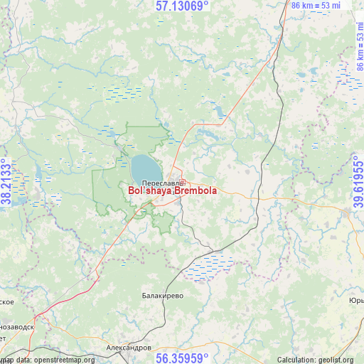
Bol’shaya Brembola GPS coordinates[2]
56° 44' 49.632" North, 38° 54' 59.112" East
| Map corner | latitude | longitude |
|---|---|---|
| Upper-left | 57.13069°, | 38.2133° |
| Center: | 56.74712°, | 38.91642° |
| Lower-right: | 56.35959°, | 39.61955° |
| Map W x H: | 85.7×85.7 km | = 53.3×53.3mi |
| max Lat: | 73.50819° ⇑25.2% North |
| Bol’shaya Brembola: | 56.74712° |
| min Lat: | ⇓74.8% South 41.28413° |
| min Long | Bol’shaya Bre | max Long |
| -179.12198° | 38.91642° | 179.35046° |
| W 27.5%⇐ | ⇒72.5% E |
Elevation
Elevation of Bol’shaya Brembola is 172 m = 564 ft, and this is 30.6 m = 100 ft below average elevation for this country.
| Max E: |
2518 m = 8261 ft | 38.8% |
| Avg. | 202.6 m = 665 ft | |
| Bol’shaya Brembola | 172 m = 564 ft | |
Min E: |
-28 m = -92 ft | 61.2% |
See also: Russia elevation on elevation.city.
Geographical zone
Bol’shaya Brembola is located in North temperate zone (between Tropic of Cancer and the Arctic Circle). Distance of this North polar circle is 1091.5 km =678.2 mi to North.| Distance of | km | miles | from Bol’shaya Brembola |
|---|---|---|---|
| North Pole | 3697.4 | 2297.5 | to North |
| Arctic Circle | 1091.5 | 678.2 | to North |
| Tropic Cancer | 3703.8 | 2301.4 | to South |
| Equator | 6309.7 | 3920.7 | to South |


Nearby cities:
15 places around Bol’shaya Brembola: (largest is in red/bold)
• Aleksandrov
41.1 km =25.5 mi,  197°
197°
• Arsaki
48.4 km =30.1 mi,  213°
213°
• Balakirevo
27.2 km =16.9 mi,  189°
189°
• Berendeyevo
17.5 km =10.9 mi,  158°
158°
• Bogorodskoye
52.6 km =32.7 mi,  238°
238°
• Glebovskoe
17.1 km =10.6 mi,  230°
230°
• Ivanovskoye
15.1 km =9.4 mi,  27°
27°
• Karabanovo
49.7 km =30.9 mi, 195°
• Kolenovo
28.5 km =17.7 mi,  36°
36°
• Mukhanovo
45.8 km =28.5 mi, 233°
• Novoye
23.8 km =14.8 mi, 226°
• Pereslavl’-Zalesskiy
3.8 km =2.4 mi,  256°
256°
• Petrovsk
36.3 km =22.6 mi, 36°
• Porech’ye-Rybnoye
48.2 km =30 mi, 35°
• Strunino
46.3 km =28.8 mi, 206°
Sources, notices
• [Note1] Compared only with cities in Russia existing in our database
• [Src1] Map data: © OpenStreetMap contributors (CC-BY-SA)
• [Src2] Other city data from geonames.org with taken over terms of usage.
• [Src3] Geographical zone / Annual Mean Temperature by Robert A. Rohde @ Wikipedia
