Kugesi geodata
Kugesi (Chuvashia) is a populated place; located in Russia in Europe/Moscow (GMT+3) time zone. With population of 11,547 people, there are 1317 cities with bigger population in this country. Compared to other cities in Russia, 67% of cities are located further ↓South; 56.9% of cities are located further ←West and 66.8% of cities have lower elevation than Kugesi. Note1


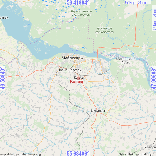
Kugesi GPS coordinates[2]
56° 1' 44.22" North, 47° 17' 33.18" East
| Map corner | latitude | longitude |
|---|---|---|
| Upper-left | 56.41984°, | 46.58943° |
| Center: | 56.02895°, | 47.29255° |
| Lower-right: | 55.63406°, | 47.99568° |
| Map W x H: | 87.4×87.4 km | = 54.3×54.3mi |
| max Lat: | 73.50819° ⇑33% North |
| Kugesi: | 56.02895° |
| min Lat: | ⇓67% South 41.28413° |
| min Long | Kugesi | max Long |
| -179.12198° | 47.29255° | 179.35046° |
| W 56.9%⇐ | ⇒43.1% E |
Elevation
Elevation of Kugesi is 187 m = 614 ft, and this is 15.6 m = 51 ft below average elevation for this country.
| Max E: |
2518 m = 8261 ft | 33.2% |
| Avg. | 202.6 m = 665 ft | |
| Kugesi | 187 m = 614 ft | |
Min E: |
-28 m = -92 ft | 66.8% |
See also: Russia elevation on elevation.city.
Geographical zone
Kugesi is located in North temperate zone (between Tropic of Cancer and the Arctic Circle). Distance of this North polar circle is 1171.3 km =727.8 mi to North.| Distance of | km | miles | from Kugesi |
|---|---|---|---|
| North Pole | 3777.2 | 2347 | to North |
| Arctic Circle | 1171.3 | 727.8 | to North |
| Tropic Cancer | 3623.9 | 2251.8 | to South |
| Equator | 6229.8 | 3871 | to South |


Nearby cities:
15 places around Kugesi: (largest is in red/bold)
• Alikovo
46.6 km =29 mi,  226°
226°
• Atlashevo
16.5 km =10.3 mi,  96°
96°
• Cheboksary
11.8 km =7.3 mi,  347°
347°
• Ishley
15.1 km =9.4 mi,  267°
267°
• Krasnoarmeyskoye
30 km =18.6 mi,  194°
194°
• Mariinskiy Posad
28.1 km =17.5 mi,  70°
70°
• Morgaushi
33 km =20.5 mi,  257°
257°
• Novocheboksarsk
14.7 km =9.1 mi,  51°
51°
• Novyye Lapsary
6.6 km =4.1 mi,  312°
312°
• Shikhazany
52.5 km =32.6 mi,  173°
173°
• Tsivil’sk
21.2 km =13.2 mi,  146°
146°
• Urmary
56.3 km =35 mi,  133°
133°
• Vilovatovo
45.7 km =28.4 mi,  290°
290°
• Yantikovo
44.9 km =27.9 mi,  120°
120°
• Zvenigovo
45.2 km =28.1 mi, 97°
Sources, notices
• [Note1] Compared only with cities in Russia existing in our database
• [Src1] Map data: © OpenStreetMap contributors (CC-BY-SA)
• [Src2] Other city data from geonames.org with taken over terms of usage.
• [Src3] Geographical zone / Annual Mean Temperature by Robert A. Rohde @ Wikipedia
