Vereshchagino geodata
Vereshchagino (Perm) is a populated place; located in Russia in Asia/Yekaterinburg (GMT+5) time zone. With population of 22,451 people, there are 804 cities with bigger population in this country. Compared to other cities in Russia, 83% of cities are located further ↓South; 66.2% of cities are located further ←West and 78.4% of cities have lower elevation than Vereshchagino. Note1


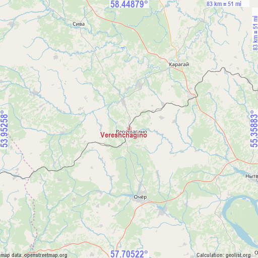
Vereshchagino GPS coordinates[2]
58° 4' 44.184" North, 54° 39' 20.52" East
| Map corner | latitude | longitude |
|---|---|---|
| Upper-left | 58.44879°, | 53.95258° |
| Center: | 58.07894°, | 54.6557° |
| Lower-right: | 57.70522°, | 55.35883° |
| Map W x H: | 82.7×82.7 km | = 51.4×51.4mi |
| max Lat: | 73.50819° ⇑17% North |
| Vereshchagino: | 58.07894° |
| min Lat: | ⇓83% South 41.28413° |
| min Long | Vereshchagino | max Long |
| -179.12198° | 54.6557° | 179.35046° |
| W 66.2%⇐ | ⇒33.8% E |
Elevation
Elevation of Vereshchagino is 237 m = 778 ft, and this is 34.4 m = 113 ft above average elevation for this country.
| Max E: |
2518 m = 8261 ft | 21.6% |
| Vereshchagino | 237 m 778 ft | |
| Avg. | 202.6 m = 665 ft | |
Min E: |
-28 m = -92 ft | 78.4% |
See also: Russia elevation on elevation.city.
Geographical zone
Vereshchagino is located in North temperate zone (between Tropic of Cancer and the Arctic Circle). Distance of this North polar circle is 943.4 km =586.2 mi to North.| Distance of | km | miles | from Vereshchagino |
|---|---|---|---|
| North Pole | 3549.3 | 2205.4 | to North |
| Arctic Circle | 943.4 | 586.2 | to North |
| Tropic Cancer | 3851.9 | 2393.5 | to South |
| Equator | 6457.8 | 4012.7 | to South |


Nearby cities:
15 places around Vereshchagino: (largest is in red/bold)
• Chaykovskaya
52 km =32.3 mi,  83°
83°
• Debesy
69 km =42.9 mi,  226°
226°
• Karagay
26.6 km =16.5 mi,  38°
38°
• Kez
59.2 km =36.8 mi,  249°
249°
• Krasnokamsk
64.6 km =40.1 mi,  89°
89°
• Mendeleyevo
22.4 km =13.9 mi,  63°
63°
• Nytva
43 km =26.7 mi,  110°
110°
• Ochër
21.3 km =13.2 mi,  169°
169°
• Okhansk
58.9 km =36.6 mi,  132°
132°
• Overyata
71.2 km =44.2 mi, 89°
• Pavlovskiy
28.5 km =17.7 mi,  157°
157°
• Siva
37.4 km =23.2 mi,  334°
334°
• Ust’-Kachka
60.4 km =37.5 mi,  97°
97°
• Yugo-Kamskiy
69.3 km =43.1 mi, 127°
• Zyukayka
14.3 km =8.9 mi,  12°
12°
Sources, notices
• [Note1] Compared only with cities in Russia existing in our database
• [Src1] Map data: © OpenStreetMap contributors (CC-BY-SA)
• [Src2] Other city data from geonames.org with taken over terms of usage.
• [Src3] Geographical zone / Annual Mean Temperature by Robert A. Rohde @ Wikipedia
