Debesy geodata
Debesy (Udmurtiya Republic) is a seat of a second-order administrative division; located in Russia in Europe/Samara (GMT+4) time zone. With population of 5,800 people, there are 2331 cities with bigger population in this country. Compared to other cities in Russia, 80.7% of cities are located further ↓South; 65.5% of cities are located further ←West and 70.2% of cities have lower elevation than Debesy. Note1


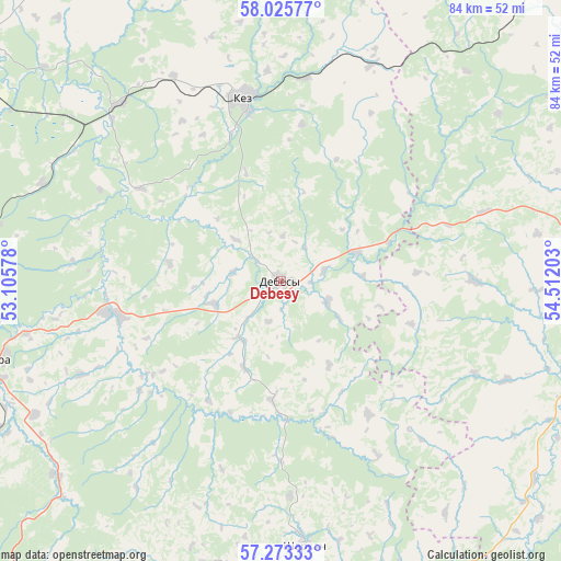
Debesy GPS coordinates[2]
57° 39' 5.4" North, 53° 48' 32.04" East
| Map corner | latitude | longitude |
|---|---|---|
| Upper-left | 58.02577°, | 53.10578° |
| Center: | 57.6515°, | 53.8089° |
| Lower-right: | 57.27333°, | 54.51203° |
| Map W x H: | 83.7×83.7 km | = 52×52mi |
| max Lat: | 73.50819° ⇑19.3% North |
| Debesy: | 57.6515° |
| min Lat: | ⇓80.7% South 41.28413° |
| min Long | Debesy | max Long |
| -179.12198° | 53.8089° | 179.35046° |
| W 65.5%⇐ | ⇒34.5% E |
Elevation
Elevation of Debesy is 198 m = 650 ft, and this is 4.6 m = 15 ft below average elevation for this country.
| Max E: |
2518 m = 8261 ft | 29.8% |
| Avg. | 202.6 m = 665 ft | |
| Debesy | 198 m = 650 ft | |
Min E: |
-28 m = -92 ft | 70.2% |
See also: Russia elevation on elevation.city.
Geographical zone
Debesy is located in North temperate zone (between Tropic of Cancer and the Arctic Circle). Distance of this North polar circle is 990.9 km =615.7 mi to North.| Distance of | km | miles | from Debesy |
|---|---|---|---|
| North Pole | 3596.8 | 2234.9 | to North |
| Arctic Circle | 990.9 | 615.7 | to North |
| Tropic Cancer | 3804.3 | 2363.9 | to South |
| Equator | 6410.2 | 3983.1 | to South |


Nearby cities:
15 places around Debesy: (largest is in red/bold)
• Balezino
59.5 km =37 mi,  307°
307°
• Chastyye
80.4 km =50 mi,  120°
120°
• Fakel
46.7 km =29 mi,  267°
267°
• Glazov
87 km =54.1 mi, 308°
• Igra
46.2 km =28.7 mi,  256°
256°
• Kez
27.7 km =17.2 mi,  348°
348°
• Khokhryaki
86.9 km =54 mi,  199°
199°
• Krasnogorskoye
78 km =48.5 mi, 274°
• Ochër
60.2 km =37.4 mi,  63°
63°
• Pavlovskiy
65 km =40.4 mi,  70°
70°
• Sharkan
39.4 km =24.5 mi,  174°
174°
• Vereshchagino
69 km =42.9 mi,  46°
46°
• Votkinsk
67.9 km =42.2 mi, 170°
• Yunda
59.9 km =37.2 mi,  295°
295°
• Zyukayka
81.2 km =50.5 mi,  40°
40°
Sources, notices
• [Note1] Compared only with cities in Russia existing in our database
• [Src1] Map data: © OpenStreetMap contributors (CC-BY-SA)
• [Src2] Other city data from geonames.org with taken over terms of usage.
• [Src3] Geographical zone / Annual Mean Temperature by Robert A. Rohde @ Wikipedia
