Trudobelikovskiy geodata
Trudobelikovskiy (Krasnodarskiy) is a populated place; located in Russia in Europe/Moscow (GMT+3) time zone. With population of 9,013 people, there are 1649 cities with bigger population in this country. Compared to other cities in Russia, 86.2% of cities are located further ↑North; 76.2% of cities are located further →East and 97.6% of cities have higher elevation than Trudobelikovskiy. Note1


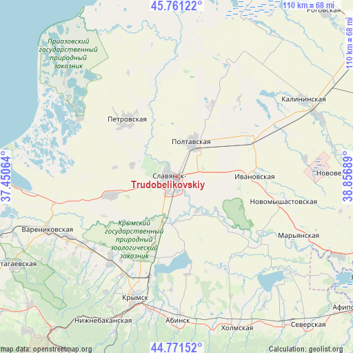
Trudobelikovskiy GPS coordinates[2]
45° 16' 6.708" North, 38° 9' 13.536" East
| Map corner | latitude | longitude |
|---|---|---|
| Upper-left | 45.76122°, | 37.45064° |
| Center: | 45.26853°, | 38.15376° |
| Lower-right: | 44.77152°, | 38.85689° |
| Map W x H: | 110×110 km | = 68.4×68.4mi |
| max Lat: | 73.50819° ⇑86.2% North |
| Trudobelikovskiy: | 45.26853° |
| min Lat: | ⇓13.8% South 41.28413° |
| min Long | Trudobelikovski | max Long |
| -179.12198° | 38.15376° | 179.35046° |
| W 23.8%⇐ | ⇒76.2% E |
Elevation
Elevation of Trudobelikovskiy is 6 m = 20 ft, and this is 196.6 m = 645 ft below average elevation for this country.
| Max E: |
2518 m = 8261 ft | 97.6% |
| Avg. | 202.6 m = 665 ft | |
| Trudobelikovskiy | 6 m = 20 ft | |
Min E: |
-28 m = -92 ft | 2.4% |
See also: Russia elevation on elevation.city.
Geographical zone
Trudobelikovskiy is located in North temperate zone (between Tropic of Cancer and the Arctic Circle). Distance of this North polar circle is 2367.8 km =1471.3 mi to North.| Distance of | km | miles | from Trudobelikovskiy |
|---|---|---|---|
| North Pole | 4973.7 | 3090.5 | to North |
| Arctic Circle | 2367.8 | 1471.3 | to North |
| Tropic Cancer | 2427.5 | 1508.4 | to South |
| Equator | 5033.4 | 3127.6 | to South |


Nearby cities:
15 places around Trudobelikovskiy: (largest is in red/bold)
• Anastasiyevskaya
21.3 km =13.2 mi,  253°
253°
• Chernoyerkovskaya
35.2 km =21.9 mi,  301°
301°
• Grivenskaya
42.2 km =26.2 mi,  2°
2°
• Kiyevskoye
33 km =20.5 mi,  219°
219°
• Korzhevskiy
35 km =21.7 mi,  256°
256°
• Krasnoarmeyskaya
11.8 km =7.3 mi,  22°
22°
• Krymsk
39.8 km =24.7 mi,  198°
198°
• Novomyshastovskaya
34.5 km =21.4 mi,  102°
102°
• Novoukrainskiy
42.4 km =26.3 mi,  191°
191°
• Petrovskaya
23.9 km =14.9 mi,  319°
319°
• Slavyansk-na-Kubani
2.6 km =1.6 mi,  237°
237°
• Sovkhoznyy
4.3 km =2.7 mi,  312°
312°
• Starodzhereliyevskaya
25.6 km =15.9 mi,  25°
25°
• Staronizhestebliyevskaya
26 km =16.2 mi,  60°
60°
• Troitskaya
15 km =9.3 mi, 188°
Sources, notices
• [Note1] Compared only with cities in Russia existing in our database
• [Src1] Map data: © OpenStreetMap contributors (CC-BY-SA)
• [Src2] Other city data from geonames.org with taken over terms of usage.
• [Src3] Geographical zone / Annual Mean Temperature by Robert A. Rohde @ Wikipedia
