Staronizhestebliyevskaya geodata
Staronizhestebliyevskaya (Krasnodarskiy) is a populated place; located in Russia in Europe/Moscow (GMT+3) time zone. With population of 10,478 people, there are 1444 cities with bigger population in this country. Compared to other cities in Russia, 85.7% of cities are located further ↑North; 74.7% of cities are located further →East and 96.8% of cities have higher elevation than Staronizhestebliyevskaya. Note1
Current local time in Staronizhestebliyevskaya:
03:20 PM, MondayDifference from your time zone: hours


Staronizhestebliyevskaya GPS coordinates[2]
45° 22' 59.34" North, 38° 26' 34.944" East
| Map corner | latitude | longitude |
|---|---|---|
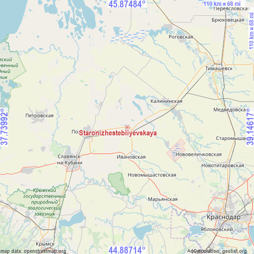
| Upper-left | 45.87484°, | 37.73992° |
| Center: | 45.38315°, | 38.44304° |
| Lower-right: | 44.88714°, | 39.14617° |
| Map W x H: | 109.8×109.8 km | = 68.2×68.2mi |
| max Lat: | 73.50819° ⇑85.7% North |
| Staronizhestebliyevskaya: | 45.38315° |
| min Lat: | ⇓14.3% South 41.28413° |
| min Long | Staronizhestebl | max Long |
| -179.12198° | 38.44304° | 179.35046° |
| W 25.3%⇐ | ⇒74.7% E |
Elevation
Elevation of Staronizhestebliyevskaya is 8 m = 26 ft, and this is 194.6 m = 638 ft below average elevation for this country.
| Max E: |
2518 m = 8261 ft | 96.8% |
| Avg. | 202.6 m = 665 ft | |
| Staronizhestebliyevskaya | 8 m = 26 ft | |
Min E: |
-28 m = -92 ft | 3.2% |
See also: Russia elevation on elevation.city.
Geographical zone
Staronizhestebliyevskaya is located in North temperate zone (between Tropic of Cancer and the Arctic Circle). Distance of this North polar circle is 2355 km =1463.3 mi to North.| Distance of | km | miles | from Staronizhestebliyevskaya |
|---|---|---|---|
| North Pole | 4960.9 | 3082.6 | to North |
| Arctic Circle | 2355 | 1463.3 | to North |
| Tropic Cancer | 2440.2 | 1516.3 | to South |
| Equator | 5046.1 | 3135.5 | to South |


Nearby cities:
15 places around Staronizhestebliyevskaya: (largest is in red/bold)
• Belozërnyy
40 km =24.9 mi,  152°
152°
• Dneprovskaya
39 km =24.2 mi,  46°
46°
• Grivenskaya
36 km =22.4 mi,  324°
324°
• Kalininskaya
20.5 km =12.7 mi,  56°
56°
• Krasnoarmeyskaya
18.2 km =11.3 mi,  264°
264°
• Novomyshastovskaya
23.2 km =14.4 mi, 151°
• Novotitarovskaya
45 km =28 mi,  111°
111°
• Novovelichkovskaya
33.3 km =20.7 mi, 110°
• Petrovskaya
38.5 km =23.9 mi,  278°
278°
• Slavyansk-na-Kubani
28.6 km =17.8 mi,  240°
240°
• Sovkhoznyy
27.5 km =17.1 mi,  249°
249°
• Starodzhereliyevskaya
15.4 km =9.6 mi,  312°
312°
• Starovelichkovskaya
23.2 km =14.4 mi,  77°
77°
• Troitskaya
37.1 km =23.1 mi,  222°
222°
• Trudobelikovskiy
26 km =16.2 mi, 240°
Sources, notices
• [Note1] Compared only with cities in Russia existing in our database
• [Src1] Map data: © OpenStreetMap contributors (CC-BY-SA)
• [Src2] Other city data from geonames.org with taken over terms of usage.
• [Src3] Geographical zone / Annual Mean Temperature by Robert A. Rohde @ Wikipedia
