Tlyustenkhabl’ geodata
Tlyustenkhabl’ (Adygeya Republic) is a section of populated place; located in Russia in Europe/Moscow (GMT+3) time zone. With population of 4,964 people, there are 2682 cities with bigger population in this country. Compared to other cities in Russia, 87.5% of cities are located further ↑North; 71.7% of cities are located further →East and 91.9% of cities have higher elevation than Tlyustenkhabl’. Note1


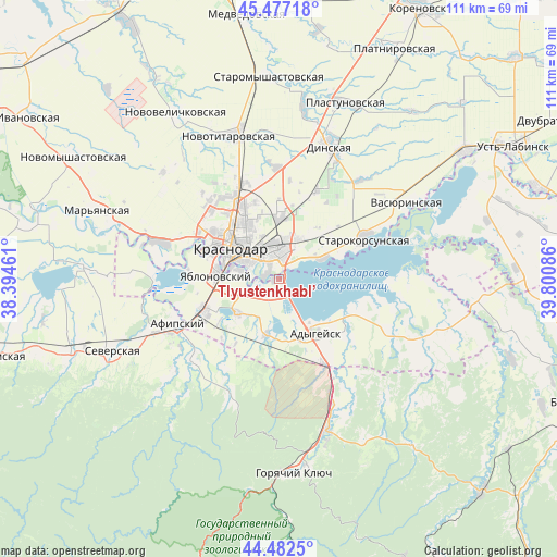
Tlyustenkhabl’ GPS coordinates[2]
44° 58' 55.2" North, 39° 5' 51.828" East
| Map corner | latitude | longitude |
|---|---|---|
| Upper-left | 45.47718°, | 38.39461° |
| Center: | 44.982°, | 39.09773° |
| Lower-right: | 44.4825°, | 39.80086° |
| Map W x H: | 110.6×110.6 km | = 68.7×68.7mi |
| max Lat: | 73.50819° ⇑87.5% North |
| Tlyustenkhabl’: | 44.982° |
| min Lat: | ⇓12.5% South 41.28413° |
| min Long | Tlyustenkhabl� | max Long |
| -179.12198° | 39.09773° | 179.35046° |
| W 28.3%⇐ | ⇒71.7% E |
Elevation
Elevation of Tlyustenkhabl’ is 22 m = 72 ft, and this is 180.6 m = 593 ft below average elevation for this country.
| Max E: |
2518 m = 8261 ft | 91.9% |
| Avg. | 202.6 m = 665 ft | |
| Tlyustenkhabl’ | 22 m = 72 ft | |
Min E: |
-28 m = -92 ft | 8.1% |
See also: Russia elevation on elevation.city.
Geographical zone
Tlyustenkhabl’ is located in North temperate zone (between Tropic of Cancer and the Arctic Circle). Distance of this Northern Tropic circle is 2395.6 km =1488.6 mi to South.| Distance of | km | miles | from Tlyustenkhabl’ |
|---|---|---|---|
| North Pole | 5005.5 | 3110.3 | to North |
| Arctic Circle | 2399.6 | 1491 | to North |
| Tropic Cancer | 2395.6 | 1488.6 | to South |
| Equator | 5001.5 | 3107.8 | to South |


Nearby cities:
15 places around Tlyustenkhabl’: (largest is in red/bold)
• Adygeysk
13.1 km =8.1 mi,  146°
146°
• Afipskiy
22 km =13.7 mi,  245°
245°
• Agronom
19.2 km =11.9 mi,  23°
23°
• Dinskaya
27.8 km =17.3 mi, 21°
• Enem
16.3 km =10.1 mi, 247°
• Krasnodar
11.8 km =7.3 mi,  306°
306°
• Novodmitriyevskaya
23.9 km =14.9 mi,  226°
226°
• Novotitarovskaya
29.9 km =18.6 mi,  342°
342°
• Pashkovskiy
4.7 km =2.9 mi,  6°
6°
• Ponezhukay
25 km =15.5 mi,  114°
114°
• Starokorsunskaya
19.1 km =11.9 mi,  64°
64°
• Takhtamukay
10.5 km =6.5 mi, 230°
• Vasyurinskaya
29.8 km =18.5 mi, 59°
• Yablonovskiy
12.2 km =7.6 mi,  273°
273°
• Yelizavetinskaya
24.8 km =15.4 mi,  286°
286°
Sources, notices
• [Note1] Compared only with cities in Russia existing in our database
• [Src1] Map data: © OpenStreetMap contributors (CC-BY-SA)
• [Src2] Other city data from geonames.org with taken over terms of usage.
• [Src3] Geographical zone / Annual Mean Temperature by Robert A. Rohde @ Wikipedia
