Takhtamukay geodata
Takhtamukay (Adygeya Republic) is a seat of a second-order administrative division; located in Russia in Europe/Moscow (GMT+3) time zone. With population of 5,120 people, there are 2598 cities with bigger population in this country. Compared to other cities in Russia, 87.7% of cities are located further ↑North; 72.1% of cities are located further →East and 88.5% of cities have higher elevation than Takhtamukay. Note1


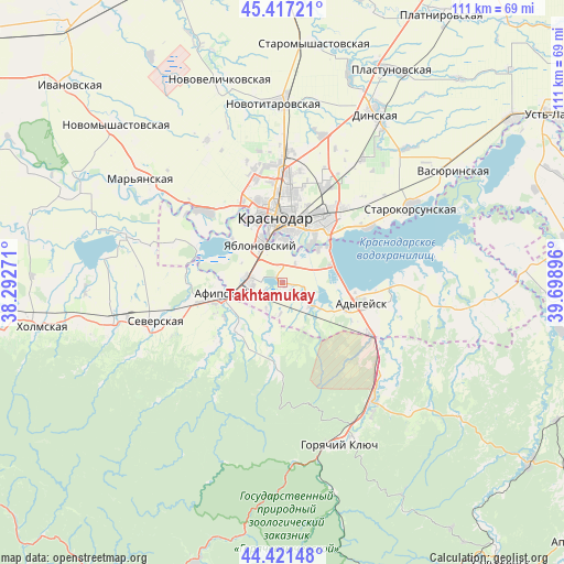
Takhtamukay GPS coordinates[2]
44° 55' 17.4" North, 38° 59' 44.988" East
| Map corner | latitude | longitude |
|---|---|---|
| Upper-left | 45.41721°, | 38.29271° |
| Center: | 44.9215°, | 38.99583° |
| Lower-right: | 44.42148°, | 39.69896° |
| Map W x H: | 110.7×110.7 km | = 68.8×68.8mi |
| max Lat: | 73.50819° ⇑87.7% North |
| Takhtamukay: | 44.9215° |
| min Lat: | ⇓12.3% South 41.28413° |
| min Long | Takhtamukay | max Long |
| -179.12198° | 38.99583° | 179.35046° |
| W 27.9%⇐ | ⇒72.1% E |
Elevation
Elevation of Takhtamukay is 34 m = 112 ft, and this is 168.6 m = 553 ft below average elevation for this country.
| Max E: |
2518 m = 8261 ft | 88.5% |
| Avg. | 202.6 m = 665 ft | |
| Takhtamukay | 34 m = 112 ft | |
Min E: |
-28 m = -92 ft | 11.5% |
See also: Russia elevation on elevation.city.
Geographical zone
Takhtamukay is located in North temperate zone (between Tropic of Cancer and the Arctic Circle). Distance of this Northern Tropic circle is 2388.9 km =1484.4 mi to South.| Distance of | km | miles | from Takhtamukay |
|---|---|---|---|
| North Pole | 5012.3 | 3114.5 | to North |
| Arctic Circle | 2406.4 | 1495.3 | to North |
| Tropic Cancer | 2388.9 | 1484.4 | to South |
| Equator | 4994.8 | 3103.6 | to South |


Nearby cities:
15 places around Takhtamukay: (largest is in red/bold)
• Adygeysk
15.9 km =9.9 mi,  105°
105°
• Afipskiy
12.3 km =7.6 mi,  258°
258°
• Agronom
28.9 km =18 mi,  32°
32°
• Belozërnyy
29.5 km =18.3 mi,  302°
302°
• Enem
7.1 km =4.4 mi,  274°
274°
• Krasnodar
13.8 km =8.6 mi,  353°
353°
• Novodmitriyevskaya
13.5 km =8.4 mi,  223°
223°
• Pashkovskiy
14.2 km =8.8 mi,  36°
36°
• Saratovskaya
29.7 km =18.5 mi,  143°
143°
• Severskaya
26.2 km =16.3 mi,  253°
253°
• Smolenskaya
21.4 km =13.3 mi,  225°
225°
• Starokorsunskaya
29.4 km =18.3 mi,  59°
59°
• Tlyustenkhabl’
10.5 km =6.5 mi,  50°
50°
• Yablonovskiy
8.6 km =5.3 mi,  331°
331°
• Yelizavetinskaya
21 km =13 mi,  311°
311°
Sources, notices
• [Note1] Compared only with cities in Russia existing in our database
• [Src1] Map data: © OpenStreetMap contributors (CC-BY-SA)
• [Src2] Other city data from geonames.org with taken over terms of usage.
• [Src3] Geographical zone / Annual Mean Temperature by Robert A. Rohde @ Wikipedia
