Temyasovo geodata
Temyasovo (Bashkortostan Republic) is a populated place; located in Russia in Asia/Yekaterinburg (GMT+5) time zone. With population of 3,524 people, there are 3386 cities with bigger population in this country. Compared to other cities in Russia, 62.8% of cities are located further ↑North; 69.6% of cities are located further ←West and 93.5% of cities have lower elevation than Temyasovo. Note1


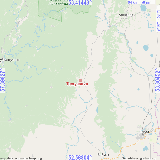
Temyasovo GPS coordinates[2]
52° 59' 35.988" North, 58° 6' 5.004" East
| Map corner | latitude | longitude |
|---|---|---|
| Upper-left | 53.41448°, | 57.39827° |
| Center: | 52.99333°, | 58.10139° |
| Lower-right: | 52.56804°, | 58.80452° |
| Map W x H: | 94.1×94.1 km | = 58.5×58.5mi |
| max Lat: | 73.50819° ⇑62.8% North |
| Temyasovo: | 52.99333° |
| min Lat: | ⇓37.2% South 41.28413° |
| min Long | Temyasovo | max Long |
| -179.12198° | 58.10139° | 179.35046° |
| W 69.6%⇐ | ⇒30.4% E |
Elevation
Elevation of Temyasovo is 558 m = 1831 ft, and this is 355.4 m = 1166 ft above average elevation for this country.
| Max E: |
2518 m = 8261 ft | 6.5% |
| Temyasovo | 558 m 1831 ft | |
| Avg. | 202.6 m = 665 ft | |
Min E: |
-28 m = -92 ft | 93.5% |
See also: Russia elevation on elevation.city.
Geographical zone
Temyasovo is located in North temperate zone (between Tropic of Cancer and the Arctic Circle). Distance of this North polar circle is 1508.9 km =937.6 mi to North.| Distance of | km | miles | from Temyasovo |
|---|---|---|---|
| North Pole | 4114.8 | 2556.8 | to North |
| Arctic Circle | 1508.9 | 937.6 | to North |
| Tropic Cancer | 3286.4 | 2042.1 | to South |
| Equator | 5892.3 | 3661.3 | to South |


Nearby cities:
15 places around Temyasovo: (largest is in red/bold)
• Abzakovo
98.4 km =61.1 mi,  19°
19°
• Agapovka
76.8 km =47.7 mi,  63°
63°
• Baymak
46.9 km =29.1 mi,  161°
161°
• Beloretsk
109.6 km =68.1 mi,  10°
10°
• Buribay
114.8 km =71.3 mi,  178°
178°
• Galiakberovo
76.2 km =47.3 mi,  293°
293°
• Lomovka
104.5 km =64.9 mi, 9°
• Magnitogorsk
78.8 km =49 mi,  53°
53°
• Mrakovo
103.8 km =64.5 mi,  252°
252°
• Sibay
48.7 km =30.3 mi,  128°
128°
• Starosubkhangulovo
45.7 km =28.4 mi, 285°
• Tubinskiy
14.1 km =8.8 mi,  144°
144°
• Tukan
103.5 km =64.3 mi,  335°
335°
• Verkhniy Avzyan
70.4 km =43.7 mi,  327°
327°
• Zilair
95.6 km =59.4 mi,  207°
207°
Sources, notices
• [Note1] Compared only with cities in Russia existing in our database
• [Src1] Map data: © OpenStreetMap contributors (CC-BY-SA)
• [Src2] Other city data from geonames.org with taken over terms of usage.
• [Src3] Geographical zone / Annual Mean Temperature by Robert A. Rohde @ Wikipedia
