Tashla geodata
Tashla (Orenburg Oblast) is a populated place; located in Russia in Asia/Yekaterinburg (GMT+5) time zone. With population of 6,651 people, there are 2088 cities with bigger population in this country. Compared to other cities in Russia, 70.6% of cities are located further ↑North; 64.6% of cities are located further ←West and 79.6% of cities have higher elevation than Tashla. Note1


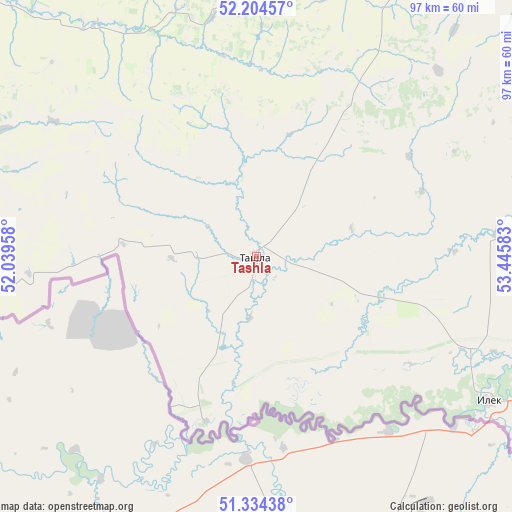
Tashla GPS coordinates[2]
51° 46' 17.652" North, 52° 44' 33.72" East
| Map corner | latitude | longitude |
|---|---|---|
| Upper-left | 52.20457°, | 52.03958° |
| Center: | 51.77157°, | 52.7427° |
| Lower-right: | 51.33438°, | 53.44583° |
| Map W x H: | 96.8×96.8 km | = 60.1×60.1mi |
| max Lat: | 73.50819° ⇑70.6% North |
| Tashla: | 51.77157° |
| min Lat: | ⇓29.4% South 41.28413° |
| min Long | Tashla | max Long |
| -179.12198° | 52.7427° | 179.35046° |
| W 64.6%⇐ | ⇒35.4% E |
Elevation
Elevation of Tashla is 72 m = 236 ft, and this is 130.6 m = 428 ft below average elevation for this country.
| Max E: |
2518 m = 8261 ft | 79.6% |
| Avg. | 202.6 m = 665 ft | |
| Tashla | 72 m = 236 ft | |
Min E: |
-28 m = -92 ft | 20.4% |
See also: Russia elevation on elevation.city.
Geographical zone
Tashla is located in North temperate zone (between Tropic of Cancer and the Arctic Circle). Distance of this North polar circle is 1644.7 km =1022 mi to North.| Distance of | km | miles | from Tashla |
|---|---|---|---|
| North Pole | 4250.6 | 2641.2 | to North |
| Arctic Circle | 1644.7 | 1022 | to North |
| Tropic Cancer | 3150.5 | 1957.6 | to South |
| Equator | 5756.5 | 3576.9 | to South |


Nearby cities:
15 places around Tashla: (largest is in red/bold)
• Borskoye
156.6 km =97.3 mi,  333°
333°
• Buzuluk
116.8 km =72.6 mi,  343°
343°
• Ilek
51.9 km =32.2 mi,  121°
121°
• Kardailovo
84.2 km =52.3 mi,  107°
107°
• Koltubanovskiy
138.8 km =86.2 mi, 339°
• Krasnogvardeyets
104.3 km =64.8 mi,  345°
345°
• Krasnokholm
99.4 km =61.8 mi,  101°
101°
• Kurmanayevka
94.1 km =58.5 mi, 330°
• Nizhnepavlovka
141.9 km =88.2 mi,  92°
92°
• Novosergiyevka
71.9 km =44.7 mi,  60°
60°
• Perevolotskiy
100.4 km =62.4 mi,  83°
83°
• Pleshanovo
128.3 km =79.7 mi,  23°
23°
• Podgorodnyaya Pokrovka
154.5 km =96 mi, 87°
• Sorochinsk
78.9 km =49 mi, 21°
• Totskoye
83.8 km =52.1 mi,  0°
0°
Sources, notices
• [Note1] Compared only with cities in Russia existing in our database
• [Src1] Map data: © OpenStreetMap contributors (CC-BY-SA)
• [Src2] Other city data from geonames.org with taken over terms of usage.
• [Src3] Geographical zone / Annual Mean Temperature by Robert A. Rohde @ Wikipedia
