Kurmanayevka geodata
Kurmanayevka (Orenburg Oblast) is a populated place; located in Russia in Asia/Yekaterinburg (GMT+5) time zone. With population of 4,552 people, there are 2847 cities with bigger population in this country. Compared to other cities in Russia, 66.1% of cities are located further ↑North; 63.8% of cities are located further ←West and 77.2% of cities have higher elevation than Kurmanayevka. Note1


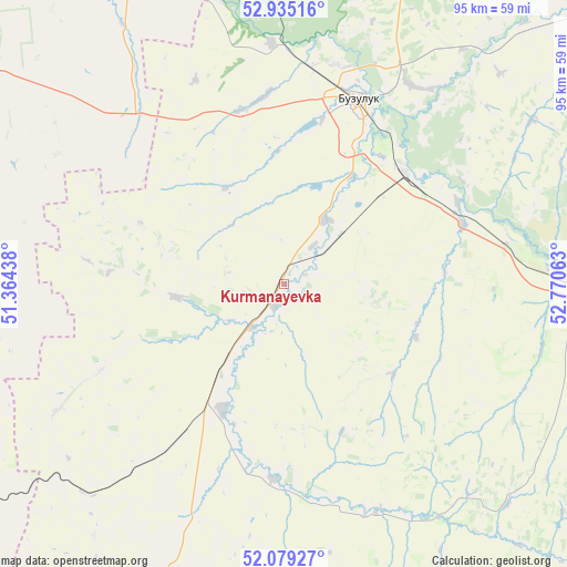
Kurmanayevka GPS coordinates[2]
52° 30' 33.48" North, 52° 4' 3" East
| Map corner | latitude | longitude |
|---|---|---|
| Upper-left | 52.93516°, | 51.36438° |
| Center: | 52.5093°, | 52.0675° |
| Lower-right: | 52.07927°, | 52.77063° |
| Map W x H: | 95.2×95.2 km | = 59.2×59.2mi |
| max Lat: | 73.50819° ⇑66.1% North |
| Kurmanayevka: | 52.5093° |
| min Lat: | ⇓33.9% South 41.28413° |
| min Long | Kurmanayevka | max Long |
| -179.12198° | 52.0675° | 179.35046° |
| W 63.8%⇐ | ⇒36.2% E |
Elevation
Elevation of Kurmanayevka is 80 m = 262 ft, and this is 122.6 m = 402 ft below average elevation for this country.
| Max E: |
2518 m = 8261 ft | 77.2% |
| Avg. | 202.6 m = 665 ft | |
| Kurmanayevka | 80 m = 262 ft | |
Min E: |
-28 m = -92 ft | 22.8% |
See also: Russia elevation on elevation.city.
Geographical zone
Kurmanayevka is located in North temperate zone (between Tropic of Cancer and the Arctic Circle). Distance of this North polar circle is 1562.7 km =971 mi to North.| Distance of | km | miles | from Kurmanayevka |
|---|---|---|---|
| North Pole | 4168.6 | 2590.2 | to North |
| Arctic Circle | 1562.7 | 971 | to North |
| Tropic Cancer | 3232.6 | 2008.6 | to South |
| Equator | 5838.5 | 3627.9 | to South |


Nearby cities:
15 places around Kurmanayevka: (largest is in red/bold)
• Bogatoye
78.7 km =48.9 mi,  321°
321°
• Borskoye
62.9 km =39.1 mi,  337°
337°
• Buzuluk
32.9 km =20.4 mi,  23°
23°
• Georgiyevka
111.3 km =69.2 mi, 319°
• Koltubanovskiy
48 km =29.8 mi,  356°
356°
• Krasnogvardeyets
27.6 km =17.1 mi,  46°
46°
• Krotovka
105.3 km =65.4 mi,  325°
325°
• Neftegorsk
69 km =42.9 mi,  298°
298°
• Otradnyy
107.8 km =67 mi, 333°
• Pleshanovo
102 km =63.4 mi,  69°
69°
• Podsolnechnoye
71.3 km =44.3 mi, 357°
• Sorochinsk
74.4 km =46.2 mi,  96°
96°
• Tashla
94.1 km =58.5 mi,  150°
150°
• Totskoye
47 km =29.2 mi,  87°
87°
• Utevka
87.1 km =54.1 mi, 300°
Sources, notices
• [Note1] Compared only with cities in Russia existing in our database
• [Src1] Map data: © OpenStreetMap contributors (CC-BY-SA)
• [Src2] Other city data from geonames.org with taken over terms of usage.
• [Src3] Geographical zone / Annual Mean Temperature by Robert A. Rohde @ Wikipedia
