Novosergiyevka geodata
Novosergiyevka (Orenburg Oblast) is a populated place; located in Russia in Asia/Yekaterinburg (GMT+5) time zone. With population of 13,188 people, there are 1196 cities with bigger population in this country. Compared to other cities in Russia, 68.6% of cities are located further ↑North; 65.2% of cities are located further ←West and 57.7% of cities have higher elevation than Novosergiyevka. Note1


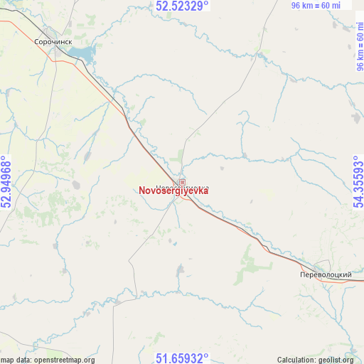
Novosergiyevka GPS coordinates[2]
52° 5' 36.24" North, 53° 39' 10.08" East
| Map corner | latitude | longitude |
|---|---|---|
| Upper-left | 52.52329°, | 52.94968° |
| Center: | 52.0934°, | 53.6528° |
| Lower-right: | 51.65932°, | 54.35593° |
| Map W x H: | 96.1×96.1 km | = 59.7×59.7mi |
| max Lat: | 73.50819° ⇑68.6% North |
| Novosergiyevka: | 52.0934° |
| min Lat: | ⇓31.4% South 41.28413° |
| min Long | Novosergiyevka | max Long |
| -179.12198° | 53.6528° | 179.35046° |
| W 65.2%⇐ | ⇒34.8% E |
Elevation
Elevation of Novosergiyevka is 129 m = 423 ft, and this is 73.6 m = 241 ft below average elevation for this country.
| Max E: |
2518 m = 8261 ft | 57.7% |
| Avg. | 202.6 m = 665 ft | |
| Novosergiyevka | 129 m = 423 ft | |
Min E: |
-28 m = -92 ft | 42.3% |
See also: Russia elevation on elevation.city.
Geographical zone
Novosergiyevka is located in North temperate zone (between Tropic of Cancer and the Arctic Circle). Distance of this North polar circle is 1608.9 km =999.7 mi to North.| Distance of | km | miles | from Novosergiyevka |
|---|---|---|---|
| North Pole | 4214.8 | 2619 | to North |
| Arctic Circle | 1608.9 | 999.7 | to North |
| Tropic Cancer | 3186.3 | 1979.9 | to South |
| Equator | 5792.2 | 3599.1 | to South |


Nearby cities:
15 places around Novosergiyevka: (largest is in red/bold)
• Ilek
65.6 km =40.8 mi,  196°
196°
• Kardailovo
64.1 km =39.8 mi,  164°
164°
• Krasnogvardeyets
109.2 km =67.9 mi,  306°
306°
• Krasnokholm
65.1 km =40.5 mi,  147°
147°
• Nizhnepavlovka
89.4 km =55.6 mi,  118°
118°
• Orenburg
105.4 km =65.5 mi,  109°
109°
• Perevolotskiy
44.2 km =27.5 mi, 123°
• Pleshanovo
83.1 km =51.6 mi,  352°
352°
• Podgorodnyaya Pokrovka
96.1 km =59.7 mi, 107°
• Prigorodnyy
116.5 km =72.4 mi, 108°
• Sakmara
115.6 km =71.8 mi,  96°
96°
• Sorochinsk
50.6 km =31.4 mi,  318°
318°
• Tashla
71.9 km =44.7 mi,  240°
240°
• Tatarskaya Kargala
105.2 km =65.4 mi, 98°
• Totskoye
77.2 km =48 mi, 308°
Sources, notices
• [Note1] Compared only with cities in Russia existing in our database
• [Src1] Map data: © OpenStreetMap contributors (CC-BY-SA)
• [Src2] Other city data from geonames.org with taken over terms of usage.
• [Src3] Geographical zone / Annual Mean Temperature by Robert A. Rohde @ Wikipedia
