Pleshanovo geodata
Pleshanovo (Orenburg Oblast) is a populated place; located in Russia in Asia/Yekaterinburg (GMT+5) time zone. With population of 3,746 people, there are 3240 cities with bigger population in this country. Compared to other cities in Russia, 63.9% of cities are located further ↑North; 65.2% of cities are located further ←West and 56.2% of cities have higher elevation than Pleshanovo. Note1


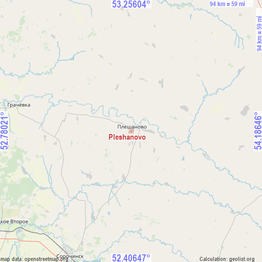
Pleshanovo GPS coordinates[2]
52° 49' 59.988" North, 53° 28' 59.988" East
| Map corner | latitude | longitude |
|---|---|---|
| Upper-left | 53.25604°, | 52.78021° |
| Center: | 52.83333°, | 53.48333° |
| Lower-right: | 52.40647°, | 54.18646° |
| Map W x H: | 94.5×94.5 km | = 58.7×58.7mi |
| max Lat: | 73.50819° ⇑63.9% North |
| Pleshanovo: | 52.83333° |
| min Lat: | ⇓36.1% South 41.28413° |
| min Long | Pleshanovo | max Long |
| -179.12198° | 53.48333° | 179.35046° |
| W 65.2%⇐ | ⇒34.8% E |
Elevation
Elevation of Pleshanovo is 132 m = 433 ft, and this is 70.6 m = 232 ft below average elevation for this country.
| Max E: |
2518 m = 8261 ft | 56.2% |
| Avg. | 202.6 m = 665 ft | |
| Pleshanovo | 132 m = 433 ft | |
Min E: |
-28 m = -92 ft | 43.8% |
See also: Russia elevation on elevation.city.
Geographical zone
Pleshanovo is located in North temperate zone (between Tropic of Cancer and the Arctic Circle). Distance of this North polar circle is 1526.7 km =948.6 mi to North.| Distance of | km | miles | from Pleshanovo |
|---|---|---|---|
| North Pole | 4132.5 | 2567.8 | to North |
| Arctic Circle | 1526.7 | 948.6 | to North |
| Tropic Cancer | 3268.6 | 2031 | to South |
| Equator | 5874.5 | 3650.2 | to South |


Nearby cities:
15 places around Pleshanovo: (largest is in red/bold)
• Abdulino
97.1 km =60.3 mi,  7°
7°
• Asekeyevo
94.2 km =58.5 mi,  330°
330°
• Bizhbulyak
109.1 km =67.8 mi,  28°
28°
• Borskoye
120.5 km =74.9 mi,  280°
280°
• Buguruslan
114.7 km =71.3 mi,  322°
322°
• Buzuluk
82.2 km =51.1 mi,  265°
265°
• Koltubanovskiy
98.4 km =61.1 mi, 276°
• Krasnogvardeyets
77.2 km =48 mi,  257°
257°
• Kurmanayevka
102 km =63.4 mi,  249°
249°
• Novosergiyevka
83.1 km =51.6 mi,  172°
172°
• Perevolotskiy
116.8 km =72.6 mi,  155°
155°
• Podsolnechnoye
104.1 km =64.7 mi,  289°
289°
• Sharlyk
85.5 km =53.1 mi,  83°
83°
• Sorochinsk
49.5 km =30.8 mi,  206°
206°
• Totskoye
59.5 km =37 mi,  234°
234°
Sources, notices
• [Note1] Compared only with cities in Russia existing in our database
• [Src1] Map data: © OpenStreetMap contributors (CC-BY-SA)
• [Src2] Other city data from geonames.org with taken over terms of usage.
• [Src3] Geographical zone / Annual Mean Temperature by Robert A. Rohde @ Wikipedia
