Tambovka geodata
Tambovka (Astrakhan) is a populated place; located in Russia in Europe/Astrakhan (GMT+4) time zone. With population of 3,528 people, there are 3382 cities with bigger population in this country. Compared to other cities in Russia, 81.6% of cities are located further ↑North; 57.1% of cities are located further ←West and 99.5% of cities have higher elevation than Tambovka. Note1


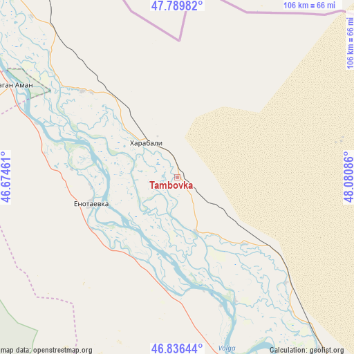
Tambovka GPS coordinates[2]
47° 18' 55.008" North, 47° 22' 39.828" East
| Map corner | latitude | longitude |
|---|---|---|
| Upper-left | 47.78982°, | 46.67461° |
| Center: | 47.31528°, | 47.37773° |
| Lower-right: | 46.83644°, | 48.08086° |
| Map W x H: | 106×106 km | = 65.9×65.9mi |
| max Lat: | 73.50819° ⇑81.6% North |
| Tambovka: | 47.31528° |
| min Lat: | ⇓18.4% South 41.28413° |
| min Long | Tambovka | max Long |
| -179.12198° | 47.37773° | 179.35046° |
| W 57.1%⇐ | ⇒42.9% E |
Elevation
Elevation of Tambovka is -19 m = -62 ft, and this is 221.6 m = 727 ft below average elevation for this country.
| Max E: |
2518 m = 8261 ft | 99.5% |
| Avg. | 202.6 m = 665 ft | |
| Tambovka | -19 m = -62 ft | |
Min E: |
-28 m = -92 ft | 0.5% |
See also: Russia elevation on elevation.city.
Geographical zone
Tambovka is located in North temperate zone (between Tropic of Cancer and the Arctic Circle). Distance of this North polar circle is 2140.2 km =1329.9 mi to North.| Distance of | km | miles | from Tambovka |
|---|---|---|---|
| North Pole | 4746.1 | 2949.1 | to North |
| Arctic Circle | 2140.2 | 1329.9 | to North |
| Tropic Cancer | 2655 | 1649.7 | to South |
| Equator | 5261 | 3269 | to South |


Nearby cities:
15 places around Tambovka: (largest is in red/bold)
• Aksarayskiy
75.4 km =46.9 mi,  140°
140°
• Astrakhan
118.6 km =73.7 mi,  154°
154°
• Chyorny Yar
126.2 km =78.4 mi,  311°
311°
• Kharabali
14.7 km =9.1 mi,  321°
321°
• Krasnyy Yar
113.9 km =70.8 mi, 139°
• Mirnyy
112.2 km =69.7 mi,  158°
158°
• Nachalovo
125.4 km =77.9 mi, 150°
• Narimanov
77.9 km =48.4 mi, 152°
• Nizhniy Baskunchak
108.6 km =67.5 mi,  337°
337°
• Sasykoli
38.9 km =24.2 mi, 312°
• Solyanka
113.9 km =70.8 mi, 154°
• Starokucherganovka
118.6 km =73.7 mi, 158°
• Tsagan Aman
56.5 km =35.1 mi,  299°
299°
• Verkhniy Baskunchak
112.5 km =69.9 mi,  334°
334°
• Yenotayevka
27.5 km =17.1 mi,  253°
253°
Sources, notices
• [Note1] Compared only with cities in Russia existing in our database
• [Src1] Map data: © OpenStreetMap contributors (CC-BY-SA)
• [Src2] Other city data from geonames.org with taken over terms of usage.
• [Src3] Geographical zone / Annual Mean Temperature by Robert A. Rohde @ Wikipedia
