Chyorny Yar geodata
Chyorny Yar (Astrakhan) is a populated place; located in Russia in Europe/Astrakhan (GMT+4) time zone. With population of 8,006 people, there are 1796 cities with bigger population in this country. Compared to other cities in Russia, 80.4% of cities are located further ↑North; 53.1% of cities are located further ←West and 98.8% of cities have higher elevation than Chyorny Yar. Note1


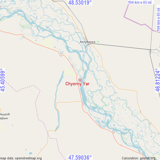
Chyorny Yar GPS coordinates[2]
48° 3' 44.712" North, 46° 6' 32.796" East
| Map corner | latitude | longitude |
|---|---|---|
| Upper-left | 48.53019°, | 45.40599° |
| Center: | 48.06242°, | 46.10911° |
| Lower-right: | 47.59036°, | 46.81224° |
| Map W x H: | 104.5×104.5 km | = 64.9×64.9mi |
| max Lat: | 73.50819° ⇑80.4% North |
| Chyorny Yar: | 48.06242° |
| min Lat: | ⇓19.6% South 41.28413° |
| min Long | Chyorny Yar | max Long |
| -179.12198° | 46.10911° | 179.35046° |
| W 53.1%⇐ | ⇒46.9% E |
Elevation
Elevation of Chyorny Yar is 1 m = 3 ft, and this is 201.6 m = 661 ft below average elevation for this country.
| Max E: |
2518 m = 8261 ft | 98.8% |
| Avg. | 202.6 m = 665 ft | |
| Chyorny Yar | 1 m = 3 ft | |
Min E: |
-28 m = -92 ft | 1.2% |
See also: Russia elevation on elevation.city.
Geographical zone
Chyorny Yar is located in North temperate zone (between Tropic of Cancer and the Arctic Circle). Distance of this North polar circle is 2057.1 km =1278.2 mi to North.| Distance of | km | miles | from Chyorny Yar |
|---|---|---|---|
| North Pole | 4663 | 2897.5 | to North |
| Arctic Circle | 2057.1 | 1278.2 | to North |
| Tropic Cancer | 2738.1 | 1701.4 | to South |
| Equator | 5344 | 3320.6 | to South |


Nearby cities:
15 places around Chyorny Yar: (largest is in red/bold)
• Akhtubinsk
24.6 km =15.3 mi,  10°
10°
• Kapustin Yar
63.7 km =39.6 mi,  334°
334°
• Kharabali
111.7 km =69.4 mi,  129°
129°
• Leninsk
97.9 km =60.8 mi,  316°
316°
• Malyye Derbety
106.9 km =66.4 mi,  263°
263°
• Nizhniy Baskunchak
56.4 km =35 mi,  71°
71°
• Sadovoye
122.5 km =76.1 mi,  254°
254°
• Sasykoli
87.3 km =54.2 mi, 130°
• Srednyaya Akhtuba
116.6 km =72.5 mi,  308°
308°
• Svetlyy Yar
108.5 km =67.4 mi,  295°
295°
• Tsagan Aman
71.9 km =44.7 mi,  140°
140°
• Verkhniy Baskunchak
48.9 km =30.4 mi, 68°
• Yenotayevka
114 km =70.8 mi, 142°
• Zaplavnoye
107.4 km =66.7 mi, 311°
• Znamensk
64.3 km =40 mi, 334°
Sources, notices
• [Note1] Compared only with cities in Russia existing in our database
• [Src1] Map data: © OpenStreetMap contributors (CC-BY-SA)
• [Src2] Other city data from geonames.org with taken over terms of usage.
• [Src3] Geographical zone / Annual Mean Temperature by Robert A. Rohde @ Wikipedia
