Tsagan Aman geodata
Tsagan Aman (Kalmykiya Republic) is a populated place; located in Russia in Europe/Moscow (GMT+3) time zone. With population of 5,769 people, there are 2341 cities with bigger population in this country. Compared to other cities in Russia, 81.1% of cities are located further ↑North; 55% of cities are located further ←West and 99.2% of cities have higher elevation than Tsagan Aman. Note1


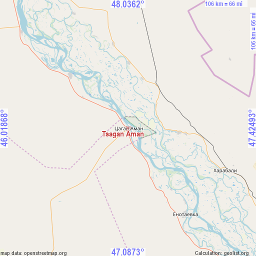
Tsagan Aman GPS coordinates[2]
47° 33' 50.04" North, 46° 43' 18.48" East
| Map corner | latitude | longitude |
|---|---|---|
| Upper-left | 48.0362°, | 46.01868° |
| Center: | 47.5639°, | 46.7218° |
| Lower-right: | 47.0873°, | 47.42493° |
| Map W x H: | 105.5×105.5 km | = 65.6×65.6mi |
| max Lat: | 73.50819° ⇑81.1% North |
| Tsagan Aman: | 47.5639° |
| min Lat: | ⇓18.9% South 41.28413° |
| min Long | Tsagan Aman | max Long |
| -179.12198° | 46.7218° | 179.35046° |
| W 55%⇐ | ⇒45% E |
Elevation
Elevation of Tsagan Aman is -7 m = -23 ft, and this is 209.6 m = 688 ft below average elevation for this country.
| Max E: |
2518 m = 8261 ft | 99.2% |
| Avg. | 202.6 m = 665 ft | |
| Tsagan Aman | -7 m = -23 ft | |
Min E: |
-28 m = -92 ft | 0.8% |
See also: Russia elevation on elevation.city.
Geographical zone
Tsagan Aman is located in North temperate zone (between Tropic of Cancer and the Arctic Circle). Distance of this North polar circle is 2112.6 km =1312.7 mi to North.| Distance of | km | miles | from Tsagan Aman |
|---|---|---|---|
| North Pole | 4718.5 | 2931.9 | to North |
| Arctic Circle | 2112.6 | 1312.7 | to North |
| Tropic Cancer | 2682.7 | 1667 | to South |
| Equator | 5288.6 | 3286.2 | to South |


Nearby cities:
15 places around Tsagan Aman: (largest is in red/bold)
• Akhtubinsk
89.5 km =55.6 mi,  332°
332°
• Aksarayskiy
129.9 km =80.7 mi,  131°
131°
• Chyorny Yar
71.9 km =44.7 mi,  320°
320°
• Kapustin Yar
134.4 km =83.5 mi, 327°
• Kharabali
43.3 km =26.9 mi,  111°
111°
• Malyye Derbety
158.6 km =98.5 mi,  285°
285°
• Mirnyy
160.2 km =99.5 mi,  145°
145°
• Narimanov
129.1 km =80.2 mi,  138°
138°
• Nizhniy Baskunchak
73.4 km =45.6 mi,  6°
6°
• Sasykoli
20.7 km =12.9 mi,  93°
93°
• Tambovka
56.5 km =35.1 mi,  119°
119°
• Utta
144 km =89.5 mi,  202°
202°
• Verkhniy Baskunchak
73.6 km =45.7 mi,  359°
359°
• Yenotayevka
42.2 km =26.2 mi, 146°
• Znamensk
135.1 km =83.9 mi, 327°
Sources, notices
• [Note1] Compared only with cities in Russia existing in our database
• [Src1] Map data: © OpenStreetMap contributors (CC-BY-SA)
• [Src2] Other city data from geonames.org with taken over terms of usage.
• [Src3] Geographical zone / Annual Mean Temperature by Robert A. Rohde @ Wikipedia
