Talovyy geodata
Talovyy (Rostov) is a populated place; located in Russia in Europe/Moscow (GMT+3) time zone. With population of 5,909 people, there are 2292 cities with bigger population in this country. Compared to other cities in Russia, 80.7% of cities are located further ↑North; 67% of cities are located further →East and 57.8% of cities have lower elevation than Talovyy. Note1


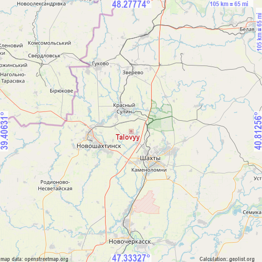
Talovyy GPS coordinates[2]
47° 48' 27.54" North, 40° 6' 33.948" East
| Map corner | latitude | longitude |
|---|---|---|
| Upper-left | 48.27774°, | 39.40631° |
| Center: | 47.80765°, | 40.10943° |
| Lower-right: | 47.33327°, | 40.81256° |
| Map W x H: | 105×105 km | = 65.2×65.2mi |
| max Lat: | 73.50819° ⇑80.7% North |
| Talovyy: | 47.80765° |
| min Lat: | ⇓19.3% South 41.28413° |
| min Long | Talovyy | max Long |
| -179.12198° | 40.10943° | 179.35046° |
| W 33%⇐ | ⇒67% E |
Elevation
Elevation of Talovyy is 163 m = 535 ft, and this is 39.6 m = 130 ft below average elevation for this country.
| Max E: |
2518 m = 8261 ft | 42.2% |
| Avg. | 202.6 m = 665 ft | |
| Talovyy | 163 m = 535 ft | |
Min E: |
-28 m = -92 ft | 57.8% |
See also: Russia elevation on elevation.city.
Geographical zone
Talovyy is located in North temperate zone (between Tropic of Cancer and the Arctic Circle). Distance of this North polar circle is 2085.5 km =1295.9 mi to North.| Distance of | km | miles | from Talovyy |
|---|---|---|---|
| North Pole | 4691.3 | 2915 | to North |
| Arctic Circle | 2085.5 | 1295.9 | to North |
| Tropic Cancer | 2709.8 | 1683.8 | to South |
| Equator | 5315.7 | 3303 | to South |


Nearby cities:
15 places around Talovyy: (largest is in red/bold)
• Almaznyy
26.8 km =16.7 mi,  349°
349°
• Ayutinskiy
4 km =2.5 mi,  134°
134°
• Gornyy
7.1 km =4.4 mi,  82°
82°
• Gukovo
31.1 km =19.3 mi,  335°
335°
• Kamenolomni
17 km =10.6 mi,  155°
155°
• Krasnyy Sulin
9.8 km =6.1 mi, 342°
• Krasyukovskaya
28.4 km =17.6 mi,  180°
180°
• Likhoy
36.2 km =22.5 mi,  11°
11°
• Mayskiy
12.4 km =7.7 mi, 182°
• Novoshakhtinsk
14.2 km =8.8 mi,  248°
248°
• Novosvetlovsky
19 km =11.8 mi, 163°
• Sambek
22 km =13.7 mi, 250°
• Shakhty
13.5 km =8.4 mi,  144°
144°
• Sokolovo-Kundryuchenskiy
12.5 km =7.8 mi,  284°
284°
• Zverevo
23.8 km =14.8 mi,  2°
2°
Sources, notices
• [Note1] Compared only with cities in Russia existing in our database
• [Src1] Map data: © OpenStreetMap contributors (CC-BY-SA)
• [Src2] Other city data from geonames.org with taken over terms of usage.
• [Src3] Geographical zone / Annual Mean Temperature by Robert A. Rohde @ Wikipedia
