Sokolovo-Kundryuchenskiy geodata
Sokolovo-Kundryuchenskiy (Rostov) is a populated place; located in Russia in Europe/Moscow (GMT+3) time zone. With population of 9,585 people, there are 1574 cities with bigger population in this country. Compared to other cities in Russia, 80.6% of cities are located further ↑North; 67.8% of cities are located further →East and 59.2% of cities have higher elevation than Sokolovo-Kundryuchenskiy. Note1
Current local time in Sokolovo-Kundryuchenskiy:
04:45 PM, MondayDifference from your time zone: hours


Sokolovo-Kundryuchenskiy GPS coordinates[2]
47° 50' 7.296" North, 39° 56' 49.596" East
| Map corner | latitude | longitude |
|---|---|---|
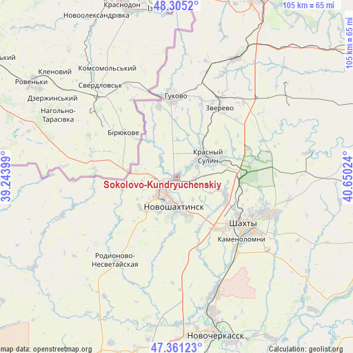
| Upper-left | 48.3052°, | 39.24399° |
| Center: | 47.83536°, | 39.94711° |
| Lower-right: | 47.36123°, | 40.65024° |
| Map W x H: | 105×105 km | = 65.2×65.2mi |
| max Lat: | 73.50819° ⇑80.6% North |
| Sokolovo-Kundryuchenskiy: | 47.83536° |
| min Lat: | ⇓19.4% South 41.28413° |
| min Long | Sokolovo-Kundry | max Long |
| -179.12198° | 39.94711° | 179.35046° |
| W 32.2%⇐ | ⇒67.8% E |
Elevation
Elevation of Sokolovo-Kundryuchenskiy is 126 m = 413 ft, and this is 76.6 m = 251 ft below average elevation for this country.
| Max E: |
2518 m = 8261 ft | 59.2% |
| Avg. | 202.6 m = 665 ft | |
| Sokolovo-Kundryuchenskiy | 126 m = 413 ft | |
Min E: |
-28 m = -92 ft | 40.8% |
See also: Russia elevation on elevation.city.
Geographical zone
Sokolovo-Kundryuchenskiy is located in North temperate zone (between Tropic of Cancer and the Arctic Circle). Distance of this North polar circle is 2082.4 km =1293.9 mi to North.| Distance of | km | miles | from Sokolovo-Kundryuchenskiy |
|---|---|---|---|
| North Pole | 4688.3 | 2913.2 | to North |
| Arctic Circle | 2082.4 | 1293.9 | to North |
| Tropic Cancer | 2712.9 | 1685.7 | to South |
| Equator | 5318.8 | 3304.9 | to South |


Nearby cities:
15 places around Sokolovo-Kundryuchenskiy: (largest is in red/bold)
• Almaznyy
24.4 km =15.2 mi,  17°
17°
• Ayutinskiy
16.1 km =10 mi,  111°
111°
• Gornyy
19.3 km =12 mi,  96°
96°
• Gukovo
25.2 km =15.7 mi,  358°
358°
• Kamenolomni
26.8 km =16.7 mi,  133°
133°
• Krasnyy Sulin
11.2 km =7 mi,  55°
55°
• Mayskiy
19.4 km =12.1 mi,  143°
143°
• Novoshakhtinsk
8.4 km =5.2 mi,  187°
187°
• Novosvetlovsky
27.6 km =17.1 mi, 140°
• Rodionovo-Nesvetaiskoye
32 km =19.9 mi,  215°
215°
• Rodionovo-Nesvetayskaya
30.6 km =19 mi, 215°
• Sambek
13.4 km =8.3 mi, 220°
• Shakhty
24.4 km =15.2 mi, 125°
• Talovyy
12.5 km =7.8 mi, 104°
• Zverevo
24.5 km =15.2 mi,  32°
32°
Sources, notices
• [Note1] Compared only with cities in Russia existing in our database
• [Src1] Map data: © OpenStreetMap contributors (CC-BY-SA)
• [Src2] Other city data from geonames.org with taken over terms of usage.
• [Src3] Geographical zone / Annual Mean Temperature by Robert A. Rohde @ Wikipedia
