Syktyvkar geodata
Syktyvkar (Komi) is a seat of a first-order administrative division; located in Russia in Europe/Moscow (GMT+3) time zone. With population of 230,139 people, there are 85 cities with bigger population in this country. Compared to other cities in Russia, 94.1% of cities are located further ↓South; 62.9% of cities are located further ←West and 50.8% of cities have lower elevation than Syktyvkar. Note1


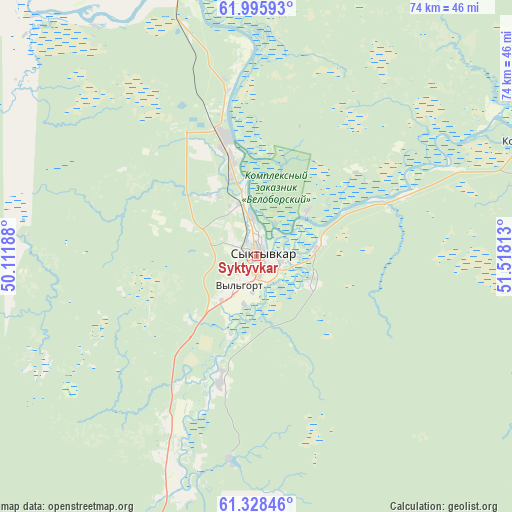
Syktyvkar GPS coordinates[2]
61° 39' 50.4" North, 50° 48' 54" East
| Map corner | latitude | longitude |
|---|---|---|
| Upper-left | 61.99593°, | 50.11188° |
| Center: | 61.664°, | 50.815° |
| Lower-right: | 61.32846°, | 51.51813° |
| Map W x H: | 74.2×74.2 km | = 46.1×46.1mi |
| max Lat: | 73.50819° ⇑5.9% North |
| Syktyvkar: | 61.664° |
| min Lat: | ⇓94.1% South 41.28413° |
| min Long | Syktyvkar | max Long |
| -179.12198° | 50.815° | 179.35046° |
| W 62.9%⇐ | ⇒37.1% E |
Elevation
Elevation of Syktyvkar is 146 m = 479 ft, and this is 56.6 m = 186 ft below average elevation for this country.
| Max E: |
2518 m = 8261 ft | 49.2% |
| Avg. | 202.6 m = 665 ft | |
| Syktyvkar | 146 m = 479 ft | |
Min E: |
-28 m = -92 ft | 50.8% |
See also: Syktyvkar elevation on elevation.city.
Geographical zone
Syktyvkar is located in North temperate zone (between Tropic of Cancer and the Arctic Circle). Distance of this North polar circle is 544.8 km =338.5 mi to North.| Distance of | km | miles | from Syktyvkar |
|---|---|---|---|
| North Pole | 3150.7 | 1957.8 | to North |
| Arctic Circle | 544.8 | 338.5 | to North |
| Tropic Cancer | 4250.5 | 2641.1 | to South |
| Equator | 6856.4 | 4260.4 | to South |


Nearby cities:
15 places around Syktyvkar: (largest is in red/bold)
• Aykino
75.8 km =47.1 mi,  325°
325°
• Ezhva
17.2 km =10.7 mi,  344°
344°
• Kortkeros
43.5 km =27 mi,  67°
67°
• Mikun’
85.9 km =53.4 mi, 333°
• Mordino
66.9 km =41.6 mi,  121°
121°
• Sedkyrkeshch
11 km =6.8 mi,  29°
29°
• Urdoma
120.1 km =74.6 mi,  274°
274°
• Ust’-Vym’
66.3 km =41.2 mi, 340°
• Verkhnyaya Maksakovka
8.7 km =5.4 mi,  111°
111°
• Vizinga
75.7 km =47 mi,  210°
210°
• Yarensk
106.2 km =66 mi,  301°
301°
• Yb
45.3 km =28.1 mi,  195°
195°
• Yemva
103 km =64 mi,  1°
1°
• Zelenets
24.8 km =15.4 mi,  351°
351°
• Zheshart
79.4 km =49.3 mi, 304°
Sources, notices
• [Note1] Compared only with cities in Russia existing in our database
• [Src1] Map data: © OpenStreetMap contributors (CC-BY-SA)
• [Src2] Other city data from geonames.org with taken over terms of usage.
• [Src3] Geographical zone / Annual Mean Temperature by Robert A. Rohde @ Wikipedia
