Mikun’ geodata
Mikun’ (Komi) is a populated place; located in Russia in Europe/Moscow (GMT+3) time zone. With population of 11,502 people, there are 1323 cities with bigger population in this country. Compared to other cities in Russia, 95.5% of cities are located further ↓South; 62.1% of cities are located further ←West and 59.2% of cities have higher elevation than Mikun’. Note1


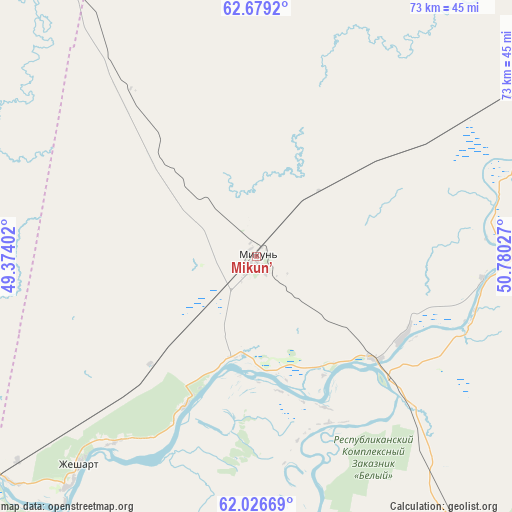
Mikun’ GPS coordinates[2]
62° 21' 16.992" North, 50° 4' 37.704" East
| Map corner | latitude | longitude |
|---|---|---|
| Upper-left | 62.6792°, | 49.37402° |
| Center: | 62.35472°, | 50.07714° |
| Lower-right: | 62.02669°, | 50.78027° |
| Map W x H: | 72.6×72.5 km | = 45.1×45mi |
| max Lat: | 73.50819° ⇑4.5% North |
| Mikun’: | 62.35472° |
| min Lat: | ⇓95.5% South 41.28413° |
| min Long | Mikun’ | max Long |
| -179.12198° | 50.07714° | 179.35046° |
| W 62.1%⇐ | ⇒37.9% E |
Elevation
Elevation of Mikun’ is 126 m = 413 ft, and this is 76.6 m = 251 ft below average elevation for this country.
| Max E: |
2518 m = 8261 ft | 59.2% |
| Avg. | 202.6 m = 665 ft | |
| Mikun’ | 126 m = 413 ft | |
Min E: |
-28 m = -92 ft | 40.8% |
See also: Russia elevation on elevation.city.
Geographical zone
Mikun’ is located in North temperate zone (between Tropic of Cancer and the Arctic Circle). Distance of this North polar circle is 468 km =290.8 mi to North.| Distance of | km | miles | from Mikun’ |
|---|---|---|---|
| North Pole | 3073.9 | 1910 | to North |
| Arctic Circle | 468 | 290.8 | to North |
| Tropic Cancer | 4327.3 | 2688.9 | to South |
| Equator | 6933.2 | 4308.1 | to South |


Nearby cities:
15 places around Mikun’: (largest is in red/bold)
• Aykino
15.1 km =9.4 mi,  196°
196°
• Ezhva
69.1 km =42.9 mi,  150°
150°
• Kortkeros
98.9 km =61.5 mi,  127°
127°
• Mezhdurechensk
125.7 km =78.1 mi,  321°
321°
• Sedkyrkeshch
80.2 km =49.8 mi, 146°
• Sindor
108.6 km =67.5 mi,  58°
58°
• Syktyvkar
85.9 km =53.4 mi, 153°
• Urdoma
104.2 km =64.7 mi,  230°
230°
• Ust’-Vym’
21.6 km =13.4 mi, 131°
• Verkhnyaya Maksakovka
92.5 km =57.5 mi, 149°
• Yarensk
55.1 km =34.2 mi,  247°
247°
• Yb
123.2 km =76.6 mi,  167°
167°
• Yemva
48 km =29.8 mi, 56°
• Zelenets
62.8 km =39 mi, 146°
• Zheshart
40.8 km =25.4 mi,  219°
219°
Sources, notices
• [Note1] Compared only with cities in Russia existing in our database
• [Src1] Map data: © OpenStreetMap contributors (CC-BY-SA)
• [Src2] Other city data from geonames.org with taken over terms of usage.
• [Src3] Geographical zone / Annual Mean Temperature by Robert A. Rohde @ Wikipedia
