Yarensk geodata
Yarensk (Arkhangelskaya) is a populated place; located in Russia in Europe/Moscow (GMT+3) time zone. With population of 3,929 people, there are 3152 cities with bigger population in this country. Compared to other cities in Russia, 95.2% of cities are located further ↓South; 60.9% of cities are located further ←West and 74% of cities have higher elevation than Yarensk. Note1


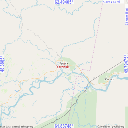
Yarensk GPS coordinates[2]
62° 10' 3.18" North, 49° 5' 29.832" East
| Map corner | latitude | longitude |
|---|---|---|
| Upper-left | 62.49405°, | 48.3885° |
| Center: | 62.16755°, | 49.09162° |
| Lower-right: | 61.83748°, | 49.79475° |
| Map W x H: | 73×73 km | = 45.4×45.4mi |
| max Lat: | 73.50819° ⇑4.8% North |
| Yarensk: | 62.16755° |
| min Lat: | ⇓95.2% South 41.28413° |
| min Long | Yarensk | max Long |
| -179.12198° | 49.09162° | 179.35046° |
| W 60.9%⇐ | ⇒39.1% E |
Elevation
Elevation of Yarensk is 91 m = 299 ft, and this is 111.6 m = 366 ft below average elevation for this country.
| Max E: |
2518 m = 8261 ft | 74% |
| Avg. | 202.6 m = 665 ft | |
| Yarensk | 91 m = 299 ft | |
Min E: |
-28 m = -92 ft | 26% |
See also: Russia elevation on elevation.city.
Geographical zone
Yarensk is located in North temperate zone (between Tropic of Cancer and the Arctic Circle). Distance of this North polar circle is 488.8 km =303.7 mi to North.| Distance of | km | miles | from Yarensk |
|---|---|---|---|
| North Pole | 3094.7 | 1923 | to North |
| Arctic Circle | 488.8 | 303.7 | to North |
| Tropic Cancer | 4306.5 | 2675.9 | to South |
| Equator | 6912.4 | 4295.2 | to South |


Nearby cities:
15 places around Yarensk: (largest is in red/bold)
• Aykino
47.1 km =29.3 mi,  82°
82°
• Ezhva
94.1 km =58.5 mi,  114°
114°
• Il’insko-Podomskoye
131 km =81.4 mi,  206°
206°
• Kharitonovo
119.5 km =74.3 mi,  224°
224°
• Mezhdurechensk
123 km =76.4 mi,  347°
347°
• Mikun’
55.1 km =34.2 mi,  67°
67°
• Sedkyrkeshch
106.1 km =65.9 mi,  115°
115°
• Syktyvkar
106.2 km =66 mi, 121°
• Urdoma
54.2 km =33.7 mi, 211°
• Ust’-Vym’
67.7 km =42.1 mi, 84°
• Verkhnyaya Maksakovka
114.7 km =71.3 mi, 121°
• Yb
126.7 km =78.7 mi,  141°
141°
• Yemva
102.5 km =63.7 mi,  62°
62°
• Zelenets
92 km =57.2 mi, 109°
• Zheshart
27.2 km =16.9 mi, 112°
Sources, notices
• [Note1] Compared only with cities in Russia existing in our database
• [Src1] Map data: © OpenStreetMap contributors (CC-BY-SA)
• [Src2] Other city data from geonames.org with taken over terms of usage.
• [Src3] Geographical zone / Annual Mean Temperature by Robert A. Rohde @ Wikipedia
