Staraya Stanitsa geodata
Staraya Stanitsa (Rostov) is a populated place; located in Russia in Europe/Moscow (GMT+3) time zone. With population of 8,284 people, there are 1750 cities with bigger population in this country. Compared to other cities in Russia, 80% of cities are located further ↑North; 66% of cities are located further →East and 87.5% of cities have higher elevation than Staraya Stanitsa. Note1


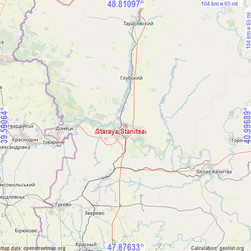
Staraya Stanitsa GPS coordinates[2]
48° 20' 44.844" North, 40° 17' 37.536" East
| Map corner | latitude | longitude |
|---|---|---|
| Upper-left | 48.81097°, | 39.59064° |
| Center: | 48.34579°, | 40.29376° |
| Lower-right: | 47.87633°, | 40.99689° |
| Map W x H: | 103.9×103.9 km | = 64.6×64.6mi |
| max Lat: | 73.50819° ⇑80% North |
| Staraya Stanitsa: | 48.34579° |
| min Lat: | ⇓20% South 41.28413° |
| min Long | Staraya Stanits | max Long |
| -179.12198° | 40.29376° | 179.35046° |
| W 34%⇐ | ⇒66% E |
Elevation
Elevation of Staraya Stanitsa is 38 m = 125 ft, and this is 164.6 m = 540 ft below average elevation for this country.
| Max E: |
2518 m = 8261 ft | 87.5% |
| Avg. | 202.6 m = 665 ft | |
| Staraya Stanitsa | 38 m = 125 ft | |
Min E: |
-28 m = -92 ft | 12.5% |
See also: Russia elevation on elevation.city.
Geographical zone
Staraya Stanitsa is located in North temperate zone (between Tropic of Cancer and the Arctic Circle). Distance of this North polar circle is 2025.6 km =1258.6 mi to North.| Distance of | km | miles | from Staraya Stanitsa |
|---|---|---|---|
| North Pole | 4631.5 | 2877.9 | to North |
| Arctic Circle | 2025.6 | 1258.6 | to North |
| Tropic Cancer | 2769.6 | 1720.9 | to South |
| Equator | 5375.5 | 3340.2 | to South |


Nearby cities:
15 places around Staraya Stanitsa: (largest is in red/bold)
• Almaznyy
38.2 km =23.7 mi,  208°
208°
• Belaya Kalitva
39.8 km =24.7 mi,  116°
116°
• Donetsk
24.7 km =15.3 mi,  268°
268°
• Glubokiy
20.4 km =12.7 mi,  7°
7°
• Gornyatskiy
46.9 km =29.1 mi,  96°
96°
• Gukovo
41.2 km =25.6 mi,  220°
220°
• Kamensk-Shakhtinskiy
4 km =2.5 mi, 219°
• Koksovyy
30.7 km =19.1 mi, 122°
• Krasnyy Sulin
53.1 km =33 mi,  198°
198°
• Likhovskoy
23.2 km =14.4 mi, 201°
• Likhoy
25.2 km =15.7 mi, 195°
• Masalovka
6.9 km =4.3 mi,  339°
339°
• Tarasovskiy
42.7 km =26.5 mi, 6°
• Uglerodovskiy
28 km =17.4 mi, 217°
• Zverevo
38.3 km =23.8 mi, 199°
Sources, notices
• [Note1] Compared only with cities in Russia existing in our database
• [Src1] Map data: © OpenStreetMap contributors (CC-BY-SA)
• [Src2] Other city data from geonames.org with taken over terms of usage.
• [Src3] Geographical zone / Annual Mean Temperature by Robert A. Rohde @ Wikipedia
