Shaturtorf geodata
Shaturtorf (Moscow Oblast) is a populated place; located in Russia in Europe/Moscow (GMT+3) time zone. With population of 3,312 people, there are 3521 cities with bigger population in this country. Compared to other cities in Russia, 59% of cities are located further ↓South; 70.3% of cities are located further →East and 53.6% of cities have higher elevation than Shaturtorf. Note1


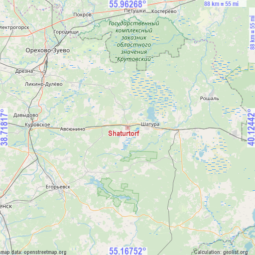
Shaturtorf GPS coordinates[2]
55° 34' 1.596" North, 39° 25' 16.644" East
| Map corner | latitude | longitude |
|---|---|---|
| Upper-left | 55.96268°, | 38.71817° |
| Center: | 55.56711°, | 39.42129° |
| Lower-right: | 55.16752°, | 40.12442° |
| Map W x H: | 88.4×88.4 km | = 54.9×54.9mi |
| max Lat: | 73.50819° ⇑41% North |
| Shaturtorf: | 55.56711° |
| min Lat: | ⇓59% South 41.28413° |
| min Long | Shaturtorf | max Long |
| -179.12198° | 39.42129° | 179.35046° |
| W 29.7%⇐ | ⇒70.3% E |
Elevation
Elevation of Shaturtorf is 137 m = 449 ft, and this is 65.6 m = 215 ft below average elevation for this country.
| Max E: |
2518 m = 8261 ft | 53.6% |
| Avg. | 202.6 m = 665 ft | |
| Shaturtorf | 137 m = 449 ft | |
Min E: |
-28 m = -92 ft | 46.4% |
See also: Russia elevation on elevation.city.
Geographical zone
Shaturtorf is located in North temperate zone (between Tropic of Cancer and the Arctic Circle). Distance of this North polar circle is 1222.7 km =759.8 mi to North.| Distance of | km | miles | from Shaturtorf |
|---|---|---|---|
| North Pole | 3828.6 | 2379 | to North |
| Arctic Circle | 1222.7 | 759.8 | to North |
| Tropic Cancer | 3572.6 | 2219.9 | to South |
| Equator | 6178.5 | 3839.1 | to South |


Nearby cities:
15 places around Shaturtorf: (largest is in red/bold)
• Avsyunino
18.7 km =11.6 mi,  269°
269°
• Baksheyevo
32.6 km =20.3 mi,  61°
61°
• Kerva
10.9 km =6.8 mi, 63°
• Krasnyy Tkach
23.9 km =14.9 mi,  243°
243°
• Kurovskoye
31.6 km =19.6 mi, 272°
• Likino-Dulevo
33.3 km =20.7 mi,  298°
298°
• Misheronskiy
26.1 km =16.2 mi,  49°
49°
• Novoye
32.3 km =20.1 mi,  282°
282°
• Roshal’
30.6 km =19 mi,  68°
68°
• Shatura
7.3 km =4.5 mi,  85°
85°
• Tugolesskiy Bor
25.4 km =15.8 mi, 94°
• Vereya
30.7 km =19.1 mi,  318°
318°
• Vozhd’ Proletariata
16.1 km =10 mi,  207°
207°
• Yegor’yevsk
31.9 km =19.8 mi,  230°
230°
• Yurtsovo
31.2 km =19.4 mi, 207°
Sources, notices
• [Note1] Compared only with cities in Russia existing in our database
• [Src1] Map data: © OpenStreetMap contributors (CC-BY-SA)
• [Src2] Other city data from geonames.org with taken over terms of usage.
• [Src3] Geographical zone / Annual Mean Temperature by Robert A. Rohde @ Wikipedia
