Shatura geodata
Shatura (Moscow Oblast) is a populated place; located in Russia in Europe/Moscow (GMT+3) time zone. With population of 30,069 people, there are 644 cities with bigger population in this country. Compared to other cities in Russia, 59.1% of cities are located further ↓South; 69.9% of cities are located further →East and 60% of cities have higher elevation than Shatura. Note1


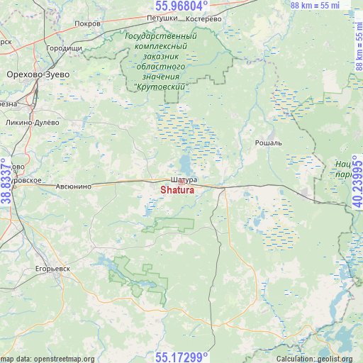
Shatura GPS coordinates[2]
55° 34' 21.108" North, 39° 32' 12.552" East
| Map corner | latitude | longitude |
|---|---|---|
| Upper-left | 55.96804°, | 38.8337° |
| Center: | 55.57253°, | 39.53682° |
| Lower-right: | 55.17299°, | 40.23995° |
| Map W x H: | 88.4×88.4 km | = 54.9×54.9mi |
| max Lat: | 73.50819° ⇑40.9% North |
| Shatura: | 55.57253° |
| min Lat: | ⇓59.1% South 41.28413° |
| min Long | Shatura | max Long |
| -179.12198° | 39.53682° | 179.35046° |
| W 30.1%⇐ | ⇒69.9% E |
Elevation
Elevation of Shatura is 124 m = 407 ft, and this is 78.6 m = 258 ft below average elevation for this country.
| Max E: |
2518 m = 8261 ft | 60% |
| Avg. | 202.6 m = 665 ft | |
| Shatura | 124 m = 407 ft | |
Min E: |
-28 m = -92 ft | 40% |
See also: Russia elevation on elevation.city.
Geographical zone
Shatura is located in North temperate zone (between Tropic of Cancer and the Arctic Circle). Distance of this North polar circle is 1222.1 km =759.4 mi to North.| Distance of | km | miles | from Shatura |
|---|---|---|---|
| North Pole | 3828 | 2378.6 | to North |
| Arctic Circle | 1222.1 | 759.4 | to North |
| Tropic Cancer | 3573.2 | 2220.3 | to South |
| Equator | 6179.1 | 3839.5 | to South |


Nearby cities:
15 places around Shatura: (largest is in red/bold)
• Avsyunino
26 km =16.2 mi,  268°
268°
• Baksheyevo
26.1 km =16.2 mi,  54°
54°
• Cherusti
29.9 km =18.6 mi,  94°
94°
• Dmitrovskiy Pogost
34.4 km =21.4 mi,  146°
146°
• Kerva
5 km =3.1 mi,  29°
29°
• Krasnyy Tkach
30.8 km =19.1 mi,  248°
248°
• Misheronskiy
20.6 km =12.8 mi,  37°
37°
• Roshal’
23.8 km =14.8 mi,  63°
63°
• Savinskaya
36.5 km =22.7 mi,  128°
128°
• Shaturtorf
7.3 km =4.5 mi, 265°
• Tugolesskiy Bor
18.2 km =11.3 mi,  97°
97°
• Vereya
35.5 km =22.1 mi,  309°
309°
• Vozhd’ Proletariata
20.9 km =13 mi,  224°
224°
• Yegor’yevsk
38.2 km =23.7 mi,  236°
236°
• Yurtsovo
35.6 km =22.1 mi, 217°
In other languages:
- In Spanish: Shatúra
- In France: Chatoura
- In Italian: Šatura
- In Russian: Шатура
- In Chinese: 沙圖拉
Sources, notices
• [Note1] Compared only with cities in Russia existing in our database
• [Src1] Map data: © OpenStreetMap contributors (CC-BY-SA)
• [Src2] Other city data from geonames.org with taken over terms of usage.
• [Src3] Geographical zone / Annual Mean Temperature by Robert A. Rohde @ Wikipedia
