Saratov geodata
Saratov (Saratovskaya Oblast) is a seat of a first-order administrative division; located in Russia in Europe/Saratov (GMT+4) time zone. With population of 863,725 people, there are 14 cities with bigger population in this country. Compared to other cities in Russia, 72.3% of cities are located further ↑North; 52.8% of cities are located further ←West and 79.6% of cities have higher elevation than Saratov. Note1


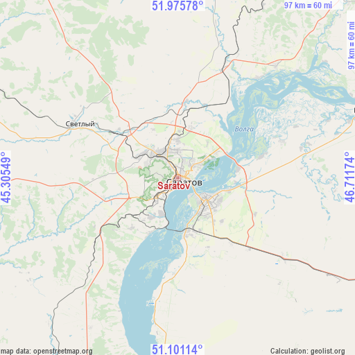
Saratov GPS coordinates[2]
51° 32' 26.016" North, 46° 0' 30.996" East
| Map corner | latitude | longitude |
|---|---|---|
| Upper-left | 51.97578°, | 45.30549° |
| Center: | 51.54056°, | 46.00861° |
| Lower-right: | 51.10114°, | 46.71174° |
| Map W x H: | 97.3×97.2 km | = 60.5×60.4mi |
| max Lat: | 73.50819° ⇑72.3% North |
| Saratov: | 51.54056° |
| min Lat: | ⇓27.7% South 41.28413° |
| min Long | Saratov | max Long |
| -179.12198° | 46.00861° | 179.35046° |
| W 52.8%⇐ | ⇒47.2% E |
Elevation
Elevation of Saratov is 72 m = 236 ft, and this is 130.6 m = 428 ft below average elevation for this country.
| Max E: |
2518 m = 8261 ft | 79.6% |
| Avg. | 202.6 m = 665 ft | |
| Saratov | 72 m = 236 ft | |
Min E: |
-28 m = -92 ft | 20.4% |
See also: Saratov elevation on elevation.city.
Geographical zone
Saratov is located in North temperate zone (between Tropic of Cancer and the Arctic Circle). Distance of this North polar circle is 1670.4 km =1037.9 mi to North.| Distance of | km | miles | from Saratov |
|---|---|---|---|
| North Pole | 4276.3 | 2657.2 | to North |
| Arctic Circle | 1670.4 | 1037.9 | to North |
| Tropic Cancer | 3124.9 | 1941.7 | to South |
| Equator | 5730.8 | 3561 | to South |


Nearby cities:
15 places around Saratov: (largest is in red/bold)
• Engel’s
9.2 km =5.7 mi,  133°
133°
• Krasnoarmeysk
61.4 km =38.2 mi,  200°
200°
• Krasnyy Oktyabr’
21.1 km =13.1 mi,  269°
269°
• Krasnyy Yar
30.2 km =18.8 mi,  70°
70°
• Marks
54.5 km =33.9 mi, 69°
• Novyye Burasy
65.9 km =40.9 mi,  3°
3°
• Privolzhskiy
14.8 km =9.2 mi,  169°
169°
• Privolzhskoye
52.2 km =32.4 mi, 71°
• Shumeyka
16.8 km =10.4 mi,  81°
81°
• Sokolovyy
12.5 km =7.8 mi,  284°
284°
• Sovetskoye
52 km =32.3 mi,  102°
102°
• Stepnoye
60.9 km =37.8 mi,  107°
107°
• Svetlyy
30 km =18.6 mi,  299°
299°
• Tatishchevo
32 km =19.9 mi, 296°
• Yelshanka
40.6 km =25.2 mi,  41°
41°
Sources, notices
• [Note1] Compared only with cities in Russia existing in our database
• [Src1] Map data: © OpenStreetMap contributors (CC-BY-SA)
• [Src2] Other city data from geonames.org with taken over terms of usage.
• [Src3] Geographical zone / Annual Mean Temperature by Robert A. Rohde @ Wikipedia
