Svetlyy geodata
Svetlyy (Saratovskaya Oblast) is a populated place; located in Russia in Europe/Saratov (GMT+4) time zone. With population of 12,222 people, there are 1257 cities with bigger population in this country. Compared to other cities in Russia, 71.3% of cities are located further ↑North; 51.8% of cities are located further ←West and 74% of cities have lower elevation than Svetlyy. Note1


Svetlyy GPS coordinates[2]
51° 40' 25.32" North, 45° 37' 49.944" East
| Map corner | latitude | longitude |
|---|---|---|
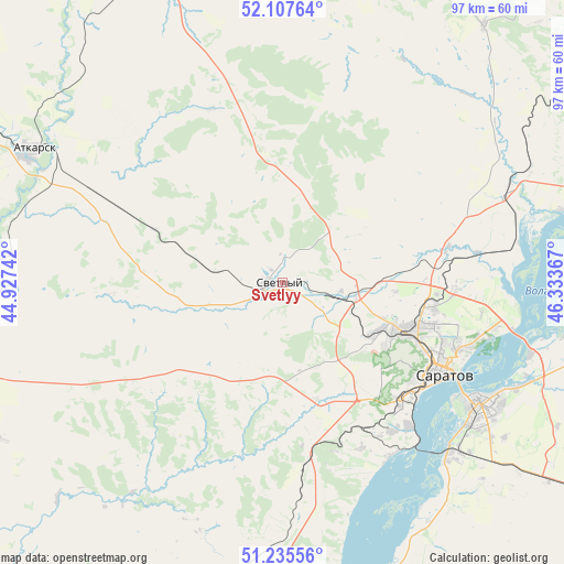
| Upper-left | 52.10764°, | 44.92742° |
| Center: | 51.6737°, | 45.63054° |
| Lower-right: | 51.23556°, | 46.33367° |
| Map W x H: | 97×97 km | = 60.3×60.3mi |
| max Lat: | 73.50819° ⇑71.3% North |
| Svetlyy: | 51.6737° |
| min Lat: | ⇓28.7% South 41.28413° |
| min Long | Svetlyy | max Long |
| -179.12198° | 45.63054° | 179.35046° |
| W 51.8%⇐ | ⇒48.2% E |
Elevation
Elevation of Svetlyy is 212 m = 696 ft, and this is 9.4 m = 31 ft above average elevation for this country.
| Max E: |
2518 m = 8261 ft | 26% |
| Svetlyy | 212 m 696 ft | |
| Avg. | 202.6 m = 665 ft | |
Min E: |
-28 m = -92 ft | 74% |
See also: Russia elevation on elevation.city.
Geographical zone
Svetlyy is located in North temperate zone (between Tropic of Cancer and the Arctic Circle). Distance of this North polar circle is 1655.6 km =1028.7 mi to North.| Distance of | km | miles | from Svetlyy |
|---|---|---|---|
| North Pole | 4261.5 | 2648 | to North |
| Arctic Circle | 1655.6 | 1028.7 | to North |
| Tropic Cancer | 3139.7 | 1950.9 | to South |
| Equator | 5745.6 | 3570.1 | to South |


Nearby cities:
15 places around Svetlyy: (largest is in red/bold)
• Atkarsk
48.2 km =30 mi,  297°
297°
• Engel’s
39 km =24.2 mi,  122°
122°
• Krasnoarmeysk
72.4 km =45 mi,  176°
176°
• Krasnyy Oktyabr’
15.7 km =9.8 mi,  161°
161°
• Krasnyy Yar
54.8 km =34.1 mi,  95°
95°
• Lysyye Gory
56.2 km =34.9 mi,  255°
255°
• Novyye Burasy
59.3 km =36.8 mi,  30°
30°
• Petrovsk
72.2 km =44.9 mi,  346°
346°
• Privolzhskiy
41.2 km =25.6 mi,  135°
135°
• Privolzhskoye
75.4 km =46.9 mi,  88°
88°
• Saratov
30 km =18.6 mi, 119°
• Shumeyka
44.4 km =27.6 mi,  106°
106°
• Sokolovyy
18.2 km =11.3 mi,  129°
129°
• Tatishchevo
2.5 km =1.6 mi, 261°
• Yelshanka
55.2 km =34.3 mi,  73°
73°
Sources, notices
• [Note1] Compared only with cities in Russia existing in our database
• [Src1] Map data: © OpenStreetMap contributors (CC-BY-SA)
• [Src2] Other city data from geonames.org with taken over terms of usage.
• [Src3] Geographical zone / Annual Mean Temperature by Robert A. Rohde @ Wikipedia
