Radchenko geodata
Radchenko (Tver’ Oblast) is a populated place; located in Russia in Europe/Moscow (GMT+3) time zone. With population of 2,022 people, there are 4136 cities with bigger population in this country. Compared to other cities in Russia, 74.2% of cities are located further ↓South; 86.6% of cities are located further →East and 57.7% of cities have higher elevation than Radchenko. Note1


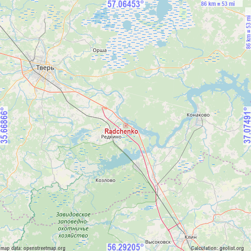
Radchenko GPS coordinates[2]
56° 40' 48.972" North, 36° 22' 18.408" East
| Map corner | latitude | longitude |
|---|---|---|
| Upper-left | 57.06453°, | 35.66866° |
| Center: | 56.68027°, | 36.37178° |
| Lower-right: | 56.29205°, | 37.07491° |
| Map W x H: | 85.9×85.9 km | = 53.4×53.4mi |
| max Lat: | 73.50819° ⇑25.8% North |
| Radchenko: | 56.68027° |
| min Lat: | ⇓74.2% South 41.28413° |
| min Long | Radchenko | max Long |
| -179.12198° | 36.37178° | 179.35046° |
| W 13.4%⇐ | ⇒86.6% E |
Elevation
Elevation of Radchenko is 129 m = 423 ft, and this is 73.6 m = 241 ft below average elevation for this country.
| Max E: |
2518 m = 8261 ft | 57.7% |
| Avg. | 202.6 m = 665 ft | |
| Radchenko | 129 m = 423 ft | |
Min E: |
-28 m = -92 ft | 42.3% |
See also: Russia elevation on elevation.city.
Geographical zone
Radchenko is located in North temperate zone (between Tropic of Cancer and the Arctic Circle). Distance of this North polar circle is 1098.9 km =682.8 mi to North.| Distance of | km | miles | from Radchenko |
|---|---|---|---|
| North Pole | 3704.8 | 2302.1 | to North |
| Arctic Circle | 1098.9 | 682.8 | to North |
| Tropic Cancer | 3696.3 | 2296.8 | to South |
| Equator | 6302.3 | 3916.1 | to South |


Nearby cities:
15 places around Radchenko: (largest is in red/bold)
• Emmaus
19.2 km =11.9 mi,  305°
305°
• Gorodnya
4.3 km =2.7 mi, 310°
• Izoplit
11 km =6.8 mi,  236°
236°
• Konakovo
24.2 km =15 mi,  84°
84°
• Kozlovo
19.9 km =12.4 mi,  197°
197°
• Novoshchapovo
43.1 km =26.8 mi,  142°
142°
• Novozavidovskiy
15 km =9.3 mi,  165°
165°
• Orsha
27.2 km =16.9 mi,  341°
341°
• Redkino
5.9 km =3.7 mi,  231°
231°
• Reshetnikovo
28.3 km =17.6 mi,  154°
154°
• Sakharovo
31.3 km =19.4 mi,  321°
321°
• Spas-Zaulok
24.9 km =15.5 mi, 151°
• Tver
34.9 km =21.7 mi,  304°
304°
• Vysokovsk
41.9 km =26 mi,  164°
164°
• Zavidovo
19.1 km =11.9 mi, 148°
Sources, notices
• [Note1] Compared only with cities in Russia existing in our database
• [Src1] Map data: © OpenStreetMap contributors (CC-BY-SA)
• [Src2] Other city data from geonames.org with taken over terms of usage.
• [Src3] Geographical zone / Annual Mean Temperature by Robert A. Rohde @ Wikipedia
