Pozhva geodata
Pozhva (Perm) is a populated place; located in Russia in Asia/Yekaterinburg (GMT+5) time zone. With population of 3,677 people, there are 3288 cities with bigger population in this country. Compared to other cities in Russia, 86.7% of cities are located further ↓South; 67.6% of cities are located further ←West and 51.9% of cities have lower elevation than Pozhva. Note1


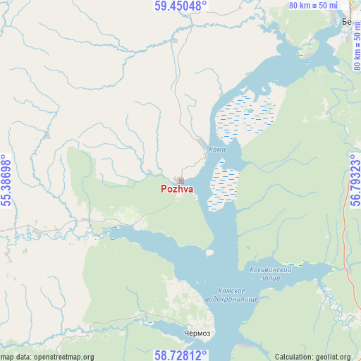
Pozhva GPS coordinates[2]
59° 5' 28.32" North, 56° 5' 24.36" East
| Map corner | latitude | longitude |
|---|---|---|
| Upper-left | 59.45048°, | 55.38698° |
| Center: | 59.0912°, | 56.0901° |
| Lower-right: | 58.72812°, | 56.79323° |
| Map W x H: | 80.3×80.3 km | = 49.9×49.9mi |
| max Lat: | 73.50819° ⇑13.3% North |
| Pozhva: | 59.0912° |
| min Lat: | ⇓86.7% South 41.28413° |
| min Long | Pozhva | max Long |
| -179.12198° | 56.0901° | 179.35046° |
| W 67.6%⇐ | ⇒32.4% E |
Elevation
Elevation of Pozhva is 149 m = 489 ft, and this is 53.6 m = 176 ft below average elevation for this country.
| Max E: |
2518 m = 8261 ft | 48.1% |
| Avg. | 202.6 m = 665 ft | |
| Pozhva | 149 m = 489 ft | |
Min E: |
-28 m = -92 ft | 51.9% |
See also: Russia elevation on elevation.city.
Geographical zone
Pozhva is located in North temperate zone (between Tropic of Cancer and the Arctic Circle). Distance of this North polar circle is 830.8 km =516.2 mi to North.| Distance of | km | miles | from Pozhva |
|---|---|---|---|
| North Pole | 3436.7 | 2135.5 | to North |
| Arctic Circle | 830.8 | 516.2 | to North |
| Tropic Cancer | 3964.4 | 2463.4 | to South |
| Equator | 6570.3 | 4082.6 | to South |


Nearby cities:
15 places around Pozhva: (largest is in red/bold)
• Aleksandrovsk
84.7 km =52.6 mi,  84°
84°
• Berezniki
54.5 km =33.9 mi,  49°
49°
• Chermoz
34.7 km =21.6 mi,  173°
173°
• Dobryanka
72.1 km =44.8 mi, 165°
• Gubakha
88.5 km =55 mi,  108°
108°
• Kizel
89.2 km =55.4 mi,  93°
93°
• Kudymkar
82.5 km =51.3 mi,  263°
263°
• Maykor
15.5 km =9.6 mi,  231°
231°
• Polazna
90.8 km =56.4 mi, 168°
• Rudnichnyy
88.6 km =55.1 mi,  96°
96°
• Shakhta
89.5 km =55.6 mi, 90°
• Solikamsk
71.3 km =44.3 mi,  32°
32°
• Ugleural’skiy
87.6 km =54.4 mi, 100°
• Usol’ye
50 km =31.1 mi,  42°
42°
• Yayva
71.8 km =44.6 mi,  67°
67°
Sources, notices
• [Note1] Compared only with cities in Russia existing in our database
• [Src1] Map data: © OpenStreetMap contributors (CC-BY-SA)
• [Src2] Other city data from geonames.org with taken over terms of usage.
• [Src3] Geographical zone / Annual Mean Temperature by Robert A. Rohde @ Wikipedia
