Pogar geodata
Pogar (Bryansk Oblast) is a populated place; located in Russia in Europe/Moscow (GMT+3) time zone. With population of 11,242 people, there are 1344 cities with bigger population in this country. Compared to other cities in Russia, 65.9% of cities are located further ↑North; 91.7% of cities are located further →East and 54.5% of cities have lower elevation than Pogar. Note1


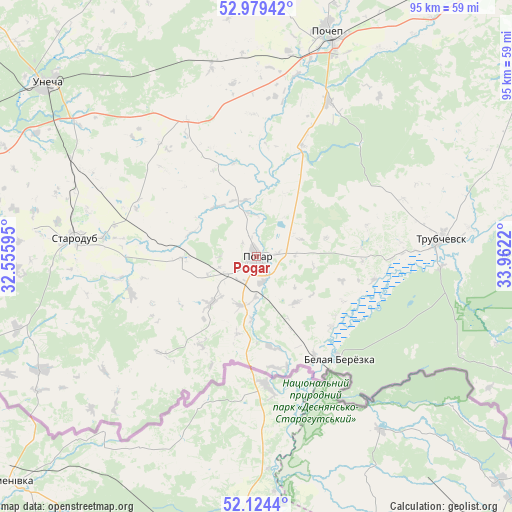
Pogar GPS coordinates[2]
52° 33' 14.364" North, 33° 15' 32.652" East
| Map corner | latitude | longitude |
|---|---|---|
| Upper-left | 52.97942°, | 32.55595° |
| Center: | 52.55399°, | 33.25907° |
| Lower-right: | 52.1244°, | 33.9622° |
| Map W x H: | 95.1×95.1 km | = 59.1×59.1mi |
| max Lat: | 73.50819° ⇑65.9% North |
| Pogar: | 52.55399° |
| min Lat: | ⇓34.1% South 41.28413° |
| min Long | Pogar | max Long |
| -179.12198° | 33.25907° | 179.35046° |
| W 8.3%⇐ | ⇒91.7% E |
Elevation
Elevation of Pogar is 155 m = 509 ft, and this is 47.6 m = 156 ft below average elevation for this country.
| Max E: |
2518 m = 8261 ft | 45.5% |
| Avg. | 202.6 m = 665 ft | |
| Pogar | 155 m = 509 ft | |
Min E: |
-28 m = -92 ft | 54.5% |
See also: Russia elevation on elevation.city.
Geographical zone
Pogar is located in North temperate zone (between Tropic of Cancer and the Arctic Circle). Distance of this North polar circle is 1557.7 km =967.9 mi to North.| Distance of | km | miles | from Pogar |
|---|---|---|---|
| North Pole | 4163.6 | 2587.1 | to North |
| Arctic Circle | 1557.7 | 967.9 | to North |
| Tropic Cancer | 3237.5 | 2011.7 | to South |
| Equator | 5843.5 | 3631 | to South |


Nearby cities:
15 places around Pogar: (largest is in red/bold)
• Ardon’
67.2 km =41.8 mi,  287°
287°
• Gulevka
70 km =43.5 mi,  275°
275°
• Kivai
60.7 km =37.7 mi, 275°
• Kokorevka
68.4 km =42.5 mi,  86°
86°
• Korzhovka-Golubovka
65.5 km =40.7 mi, 291°
• Mglin
62.6 km =38.9 mi,  333°
333°
• Novyy Ropsk
70.2 km =43.6 mi,  246°
246°
• Pochep
44.1 km =27.4 mi,  16°
16°
• Ramasukha
28.1 km =17.5 mi,  43°
43°
• Semyachki
29.4 km =18.3 mi,  69°
69°
• Starodub
33.7 km =20.9 mi, 275°
• Suzëmka
61.4 km =38.2 mi,  115°
115°
• Trubchevsk
34.3 km =21.3 mi, 85°
• Unecha
51.1 km =31.8 mi,  309°
309°
• Zaymishche
71.8 km =44.6 mi, 285°
Sources, notices
• [Note1] Compared only with cities in Russia existing in our database
• [Src1] Map data: © OpenStreetMap contributors (CC-BY-SA)
• [Src2] Other city data from geonames.org with taken over terms of usage.
• [Src3] Geographical zone / Annual Mean Temperature by Robert A. Rohde @ Wikipedia
