Ramasukha geodata
Ramasukha (Bryansk Oblast) is a populated place; located in Russia in Europe/Moscow (GMT+3) time zone. With population of 553 people, there are 4930 cities with bigger population in this country. Compared to other cities in Russia, 64.5% of cities are located further ↑North; 91.2% of cities are located further →East and 54.5% of cities have lower elevation than Ramasukha. Note1


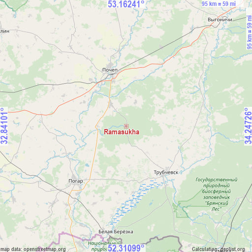
Ramasukha GPS coordinates[2]
52° 44' 19.608" North, 33° 32' 38.868" East
| Map corner | latitude | longitude |
|---|---|---|
| Upper-left | 53.16241°, | 32.84101° |
| Center: | 52.73878°, | 33.54413° |
| Lower-right: | 52.31099°, | 34.24726° |
| Map W x H: | 94.7×94.7 km | = 58.8×58.8mi |
| max Lat: | 73.50819° ⇑64.5% North |
| Ramasukha: | 52.73878° |
| min Lat: | ⇓35.5% South 41.28413° |
| min Long | Ramasukha | max Long |
| -179.12198° | 33.54413° | 179.35046° |
| W 8.8%⇐ | ⇒91.2% E |
Elevation
Elevation of Ramasukha is 155 m = 509 ft, and this is 47.6 m = 156 ft below average elevation for this country.
| Max E: |
2518 m = 8261 ft | 45.5% |
| Avg. | 202.6 m = 665 ft | |
| Ramasukha | 155 m = 509 ft | |
Min E: |
-28 m = -92 ft | 54.5% |
See also: Russia elevation on elevation.city.
Geographical zone
Ramasukha is located in North temperate zone (between Tropic of Cancer and the Arctic Circle). Distance of this North polar circle is 1537.2 km =955.2 mi to North.| Distance of | km | miles | from Ramasukha |
|---|---|---|---|
| North Pole | 4143.1 | 2574.4 | to North |
| Arctic Circle | 1537.2 | 955.2 | to North |
| Tropic Cancer | 3258.1 | 2024.5 | to South |
| Equator | 5864 | 3643.7 | to South |


Nearby cities:
15 places around Ramasukha: (largest is in red/bold)
• Altukhovo
55.9 km =34.7 mi,  97°
97°
• Dobrun’
68.4 km =42.5 mi,  43°
43°
• Glinishchevo
71.9 km =44.7 mi,  29°
29°
• Kokorevka
51.7 km =32.1 mi,  108°
108°
• Mglin
58.7 km =36.5 mi,  307°
307°
• Navlya
65 km =40.4 mi,  81°
81°
• Pochep
22.6 km =14 mi,  343°
343°
• Pogar
28.1 km =17.5 mi,  223°
223°
• Semyachki
13.2 km =8.2 mi,  140°
140°
• Starodub
55.4 km =34.4 mi,  251°
251°
• Suzëmka
59.1 km =36.7 mi, 142°
• Trubchevsk
23.1 km =14.4 mi, 139°
• Unecha
59.7 km =37.1 mi,  281°
281°
• Vygonichi
53.2 km =33.1 mi, 41°
• Zhiryatino
55.2 km =34.3 mi,  13°
13°
Sources, notices
• [Note1] Compared only with cities in Russia existing in our database
• [Src1] Map data: © OpenStreetMap contributors (CC-BY-SA)
• [Src2] Other city data from geonames.org with taken over terms of usage.
• [Src3] Geographical zone / Annual Mean Temperature by Robert A. Rohde @ Wikipedia
