Trubchevsk geodata
Trubchevsk (Bryansk Oblast) is a populated place; located in Russia in Europe/Moscow (GMT+3) time zone. With population of 16,100 people, there are 1030 cities with bigger population in this country. Compared to other cities in Russia, 65.7% of cities are located further ↑North; 90.8% of cities are located further →East and 63.3% of cities have lower elevation than Trubchevsk. Note1


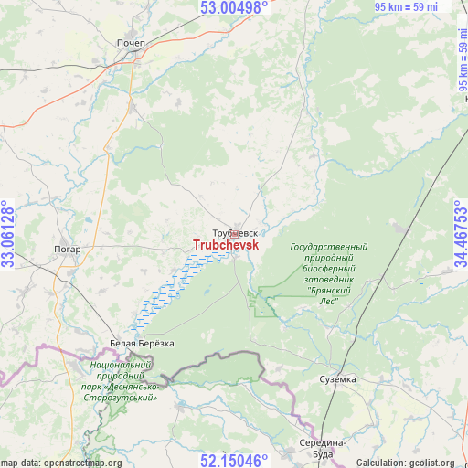
Trubchevsk GPS coordinates[2]
52° 34' 47.28" North, 33° 45' 51.84" East
| Map corner | latitude | longitude |
|---|---|---|
| Upper-left | 53.00498°, | 33.06128° |
| Center: | 52.5798°, | 33.7644° |
| Lower-right: | 52.15046°, | 34.46753° |
| Map W x H: | 95×95 km | = 59×59mi |
| max Lat: | 73.50819° ⇑65.7% North |
| Trubchevsk: | 52.5798° |
| min Lat: | ⇓34.3% South 41.28413° |
| min Long | Trubchevsk | max Long |
| -179.12198° | 33.7644° | 179.35046° |
| W 9.2%⇐ | ⇒90.8% E |
Elevation
Elevation of Trubchevsk is 177 m = 581 ft, and this is 25.6 m = 84 ft below average elevation for this country.
| Max E: |
2518 m = 8261 ft | 36.7% |
| Avg. | 202.6 m = 665 ft | |
| Trubchevsk | 177 m = 581 ft | |
Min E: |
-28 m = -92 ft | 63.3% |
See also: Russia elevation on elevation.city.
Geographical zone
Trubchevsk is located in North temperate zone (between Tropic of Cancer and the Arctic Circle). Distance of this North polar circle is 1554.8 km =966.1 mi to North.| Distance of | km | miles | from Trubchevsk |
|---|---|---|---|
| North Pole | 4160.7 | 2585.3 | to North |
| Arctic Circle | 1554.8 | 966.1 | to North |
| Tropic Cancer | 3240.4 | 2013.5 | to South |
| Equator | 5846.3 | 3632.7 | to South |


Nearby cities:
15 places around Trubchevsk: (largest is in red/bold)
• Altukhovo
42 km =26.1 mi,  75°
75°
• Kokino
69.4 km =43.1 mi,  97°
97°
• Kokorevka
34.1 km =21.2 mi,  88°
88°
• Komarichi
71.8 km =44.6 mi, 104°
• Lokot’
55 km =34.2 mi, 91°
• Navlya
56.6 km =35.2 mi,  61°
61°
• Pochep
44.8 km =27.8 mi,  331°
331°
• Pogar
34.3 km =21.3 mi,  265°
265°
• Ramasukha
23.1 km =14.4 mi,  319°
319°
• Semyachki
9.9 km =6.2 mi, 318°
• Sevsk
68.8 km =42.8 mi,  134°
134°
• Starodub
67.6 km =42 mi, 270°
• Suzëmka
36.1 km =22.4 mi,  143°
143°
• Vygonichi
61.2 km =38 mi,  19°
19°
• Zhiryatino
71.5 km =44.4 mi,  358°
358°
Sources, notices
• [Note1] Compared only with cities in Russia existing in our database
• [Src1] Map data: © OpenStreetMap contributors (CC-BY-SA)
• [Src2] Other city data from geonames.org with taken over terms of usage.
• [Src3] Geographical zone / Annual Mean Temperature by Robert A. Rohde @ Wikipedia
