Podporozh’ye geodata
Podporozh’ye (Leningradskaya Oblast') is a populated place; located in Russia in Europe/Moscow (GMT+3) time zone. With population of 19,600 people, there are 886 cities with bigger population in this country. Compared to other cities in Russia, 92.7% of cities are located further ↓South; 90.3% of cities are located further →East and 83.4% of cities have higher elevation than Podporozh’ye. Note1


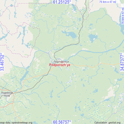
Podporozh’ye GPS coordinates[2]
60° 54' 40.464" North, 34° 10' 14.304" East
| Map corner | latitude | longitude |
|---|---|---|
| Upper-left | 61.25125°, | 33.46752° |
| Center: | 60.91124°, | 34.17064° |
| Lower-right: | 60.56757°, | 34.87377° |
| Map W x H: | 76×76 km | = 47.2×47.2mi |
| max Lat: | 73.50819° ⇑7.3% North |
| Podporozh’ye: | 60.91124° |
| min Lat: | ⇓92.7% South 41.28413° |
| min Long | Podporozh’ye | max Long |
| -179.12198° | 34.17064° | 179.35046° |
| W 9.7%⇐ | ⇒90.3% E |
Elevation
Elevation of Podporozh’ye is 56 m = 184 ft, and this is 146.6 m = 481 ft below average elevation for this country.
| Max E: |
2518 m = 8261 ft | 83.4% |
| Avg. | 202.6 m = 665 ft | |
| Podporozh’ye | 56 m = 184 ft | |
Min E: |
-28 m = -92 ft | 16.6% |
See also: Russia elevation on elevation.city.
Geographical zone
Podporozh’ye is located in North temperate zone (between Tropic of Cancer and the Arctic Circle). Distance of this North polar circle is 628.5 km =390.5 mi to North.| Distance of | km | miles | from Podporozh’ye |
|---|---|---|---|
| North Pole | 3234.4 | 2009.8 | to North |
| Arctic Circle | 628.5 | 390.5 | to North |
| Tropic Cancer | 4166.8 | 2589.1 | to South |
| Equator | 6772.7 | 4208.4 | to South |


Nearby cities:
15 places around Podporozh’ye: (largest is in red/bold)
• Essoyla
119.7 km =74.4 mi,  332°
332°
• Kvartsitnyy
79.4 km =49.3 mi,  35°
35°
• Lodeynoye Pole
39.3 km =24.4 mi,  238°
238°
• Matrosy
98.5 km =61.2 mi,  348°
348°
• Olonets
65.4 km =40.6 mi,  277°
277°
• Pasha
84 km =52.2 mi,  226°
226°
• Petrozavodsk
97.6 km =60.6 mi,  5°
5°
• Pryazha
91.7 km =57 mi,  341°
341°
• Sheltozero
81.8 km =50.8 mi,  51°
51°
• Shuya
115.8 km =72 mi,  1°
1°
• Svir'stroy
27.6 km =17.1 mi, 243°
• Vazhiny
10 km =6.2 mi,  306°
306°
• Vinnitsy
45.4 km =28.2 mi,  133°
133°
• Voznesen’ye
71.4 km =44.4 mi,  81°
81°
• Yaroslavichi
50 km =31.1 mi,  158°
158°
Sources, notices
• [Note1] Compared only with cities in Russia existing in our database
• [Src1] Map data: © OpenStreetMap contributors (CC-BY-SA)
• [Src2] Other city data from geonames.org with taken over terms of usage.
• [Src3] Geographical zone / Annual Mean Temperature by Robert A. Rohde @ Wikipedia
