Leshukonskoye geodata
Leshukonskoye (Arkhangelskaya) is a populated place; located in Russia in Europe/Moscow (GMT+3) time zone. With population of 4,813 people, there are 2738 cities with bigger population in this country. Compared to other cities in Russia, 97.5% of cities are located further ↓South; 52.2% of cities are located further ←West and 84.9% of cities have higher elevation than Leshukonskoye. Note1


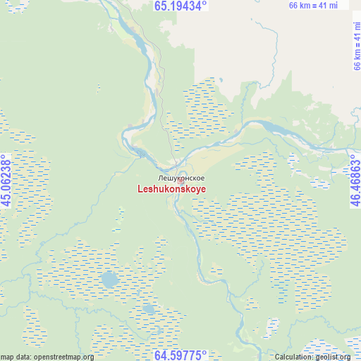
Leshukonskoye GPS coordinates[2]
64° 53' 51.72" North, 45° 45' 55.8" East
| Map corner | latitude | longitude |
|---|---|---|
| Upper-left | 65.19434°, | 45.06238° |
| Center: | 64.8977°, | 45.7655° |
| Lower-right: | 64.59775°, | 46.46863° |
| Map W x H: | 66.3×66.3 km | = 41.2×41.2mi |
| max Lat: | 73.50819° ⇑2.5% North |
| Leshukonskoye: | 64.8977° |
| min Lat: | ⇓97.5% South 41.28413° |
| min Long | Leshukonskoye | max Long |
| -179.12198° | 45.7655° | 179.35046° |
| W 52.2%⇐ | ⇒47.8% E |
Elevation
Elevation of Leshukonskoye is 48 m = 157 ft, and this is 154.6 m = 507 ft below average elevation for this country.
| Max E: |
2518 m = 8261 ft | 84.9% |
| Avg. | 202.6 m = 665 ft | |
| Leshukonskoye | 48 m = 157 ft | |
Min E: |
-28 m = -92 ft | 15.1% |
See also: Russia elevation on elevation.city.
Geographical zone
Leshukonskoye is located in North temperate zone (between Tropic of Cancer and the Arctic Circle). Distance of this North polar circle is 185.2 km =115.1 mi to North.| Distance of | km | miles | from Leshukonskoye |
|---|---|---|---|
| North Pole | 2791.1 | 1734.3 | to North |
| Arctic Circle | 185.2 | 115.1 | to North |
| Tropic Cancer | 4610 | 2864.5 | to South |
| Equator | 7215.9 | 4483.8 | to South |


Nearby cities:
15 places around Leshukonskoye: (largest is in red/bold)
• Belogorskiy
181.5 km =112.8 mi,  244°
244°
• Berëznik
272.3 km =169.2 mi,  213°
213°
• Blagoyevo
195.5 km =121.5 mi,  146°
146°
• Dvinskoy
307 km =190.8 mi,  185°
185°
• Kamenka
133.3 km =82.8 mi,  325°
325°
• Karpogory
118 km =73.3 mi, 212°
• Koslan
220.7 km =137.1 mi,  136°
136°
• Krasnoborsk
371.2 km =230.7 mi,  178°
178°
• Lukovetskiy
195.2 km =121.3 mi,  249°
249°
• Mezen’
126 km =78.3 mi, 326°
• Mezhdurechensk
228.2 km =141.8 mi, 143°
• Pinega
114.6 km =71.2 mi,  258°
258°
• Rochegda
273.5 km =169.9 mi,  204°
204°
• Usogorsk
217.7 km =135.3 mi, 139°
• Verkhnyaya Toyma
298.5 km =185.5 mi, 187°
Sources, notices
• [Note1] Compared only with cities in Russia existing in our database
• [Src1] Map data: © OpenStreetMap contributors (CC-BY-SA)
• [Src2] Other city data from geonames.org with taken over terms of usage.
• [Src3] Geographical zone / Annual Mean Temperature by Robert A. Rohde @ Wikipedia
