Karayar geodata
Karayar (Bashkortostan Republic) is a populated place; located in Russia in Asia/Yekaterinburg (GMT+5) time zone. With population of 636 people, there are 4862 cities with bigger population in this country. Compared to other cities in Russia, 61.5% of cities are located further ↓South; 68.6% of cities are located further ←West and 57.2% of cities have lower elevation than Karayar. Note1


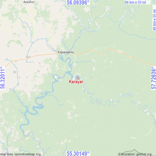
Karayar GPS coordinates[2]
55° 41' 59.028" North, 57° 1' 23.628" East
| Map corner | latitude | longitude |
|---|---|---|
| Upper-left | 56.09396°, | 56.32011° |
| Center: | 55.69973°, | 57.02323° |
| Lower-right: | 55.30149°, | 57.72636° |
| Map W x H: | 88.1×88.1 km | = 54.7×54.7mi |
| max Lat: | 73.50819° ⇑38.5% North |
| Karayar: | 55.69973° |
| min Lat: | ⇓61.5% South 41.28413° |
| min Long | Karayar | max Long |
| -179.12198° | 57.02323° | 179.35046° |
| W 68.6%⇐ | ⇒31.4% E |
Elevation
Elevation of Karayar is 161 m = 528 ft, and this is 41.6 m = 136 ft below average elevation for this country.
| Max E: |
2518 m = 8261 ft | 42.8% |
| Avg. | 202.6 m = 665 ft | |
| Karayar | 161 m = 528 ft | |
Min E: |
-28 m = -92 ft | 57.2% |
See also: Russia elevation on elevation.city.
Geographical zone
Karayar is located in North temperate zone (between Tropic of Cancer and the Arctic Circle). Distance of this North polar circle is 1207.9 km =750.6 mi to North.| Distance of | km | miles | from Karayar |
|---|---|---|---|
| North Pole | 3813.8 | 2369.8 | to North |
| Arctic Circle | 1207.9 | 750.6 | to North |
| Tropic Cancer | 3587.3 | 2229 | to South |
| Equator | 6193.2 | 3848.3 | to South |


Nearby cities:
15 places around Karayar: (largest is in red/bold)
• Asha
79.7 km =49.5 mi,  168°
168°
• Askino
51.5 km =32 mi,  327°
327°
• Bedeyeva Polyana
57.8 km =35.9 mi,  223°
223°
• Duvan
55.1 km =34.2 mi,  90°
90°
• Karaidel’
16.6 km =10.3 mi, 333°
• Krasnaya Gorka
60.3 km =37.5 mi,  201°
201°
• Krasnyy Klyuch
41.9 km =26 mi,  213°
213°
• Maginsk
7.9 km =4.9 mi, 333°
• Mesyagutovo
79.5 km =49.4 mi,  103°
103°
• Pavlovka
42.8 km =26.6 mi, 223°
• Sim
89.4 km =55.6 mi,  151°
151°
• Starobaltachevo
76.2 km =47.3 mi,  296°
296°
• Ulu-Telyak
87.2 km =54.2 mi,  181°
181°
• Urman
91.3 km =56.7 mi,  185°
185°
• Yazykovo
77.3 km =48 mi,  226°
226°
Sources, notices
• [Note1] Compared only with cities in Russia existing in our database
• [Src1] Map data: © OpenStreetMap contributors (CC-BY-SA)
• [Src2] Other city data from geonames.org with taken over terms of usage.
• [Src3] Geographical zone / Annual Mean Temperature by Robert A. Rohde @ Wikipedia
