Nyrob geodata
Nyrob (Perm) is a populated place; located in Russia in Asia/Yekaterinburg (GMT+5) time zone. With population of 7,314 people, there are 1926 cities with bigger population in this country. Compared to other cities in Russia, 92.4% of cities are located further ↓South; 68.3% of cities are located further ←West and 51.1% of cities have lower elevation than Nyrob. Note1


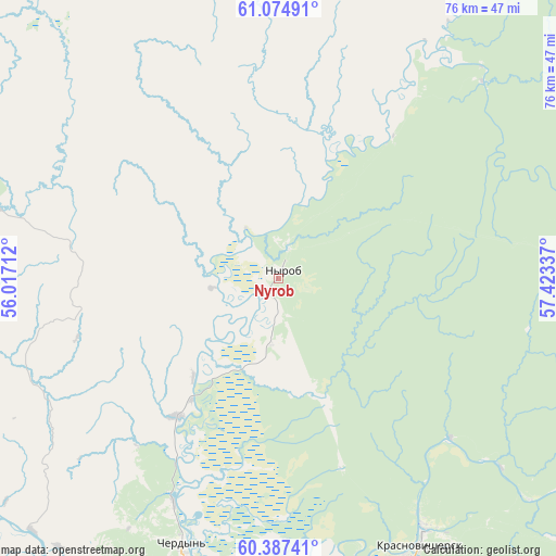
Nyrob GPS coordinates[2]
60° 43' 58.8" North, 56° 43' 12.864" East
| Map corner | latitude | longitude |
|---|---|---|
| Upper-left | 61.07491°, | 56.01712° |
| Center: | 60.733°, | 56.72024° |
| Lower-right: | 60.38741°, | 57.42337° |
| Map W x H: | 76.4×76.4 km | = 47.5×47.5mi |
| max Lat: | 73.50819° ⇑7.6% North |
| Nyrob: | 60.733° |
| min Lat: | ⇓92.4% South 41.28413° |
| min Long | Nyrob | max Long |
| -179.12198° | 56.72024° | 179.35046° |
| W 68.3%⇐ | ⇒31.7% E |
Elevation
Elevation of Nyrob is 147 m = 482 ft, and this is 55.6 m = 182 ft below average elevation for this country.
| Max E: |
2518 m = 8261 ft | 48.9% |
| Avg. | 202.6 m = 665 ft | |
| Nyrob | 147 m = 482 ft | |
Min E: |
-28 m = -92 ft | 51.1% |
See also: Russia elevation on elevation.city.
Geographical zone
Nyrob is located in North temperate zone (between Tropic of Cancer and the Arctic Circle). Distance of this North polar circle is 648.3 km =402.8 mi to North.| Distance of | km | miles | from Nyrob |
|---|---|---|---|
| North Pole | 3254.2 | 2022.1 | to North |
| Arctic Circle | 648.3 | 402.8 | to North |
| Tropic Cancer | 4147 | 2576.8 | to South |
| Equator | 6752.9 | 4196.1 | to South |


Nearby cities:
15 places around Nyrob: (largest is in red/bold)
• Aleksandrovsk
181.4 km =112.7 mi,  164°
164°
• Berezniki
147.3 km =91.5 mi,  177°
177°
• Cherdyn’
39 km =24.2 mi,  199°
199°
• Cherëmukhovo
183.6 km =114.1 mi,  103°
103°
• Gayny
139.4 km =86.6 mi,  250°
250°
• Kerchevskiy
90.6 km =56.3 mi,  194°
194°
• Kochevo
183.4 km =114 mi,  226°
226°
• Kosa
129.4 km =80.4 mi, 227°
• Krasnovishersk
41.2 km =25.6 mi,  151°
151°
• Pozhva
185.9 km =115.5 mi, 190°
• Severoural’sk
188.6 km =117.2 mi,  109°
109°
• Solikamsk
122.5 km =76.1 mi, 178°
• Tretiy Severnyy
186.9 km =116.1 mi, 108°
• Usol’ye
145.8 km =90.6 mi, 180°
• Yayva
158.3 km =98.4 mi,  169°
169°
Sources, notices
• [Note1] Compared only with cities in Russia existing in our database
• [Src1] Map data: © OpenStreetMap contributors (CC-BY-SA)
• [Src2] Other city data from geonames.org with taken over terms of usage.
• [Src3] Geographical zone / Annual Mean Temperature by Robert A. Rohde @ Wikipedia
