Balasheyka geodata
Balasheyka (Samara Oblast) is a populated place; located in Russia in Europe/Samara (GMT+4) time zone. With population of 3,080 people, there are 3710 cities with bigger population in this country. Compared to other cities in Russia, 60.5% of cities are located further ↑North; 59.1% of cities are located further ←West and 60.3% of cities have lower elevation than Balasheyka. Note1


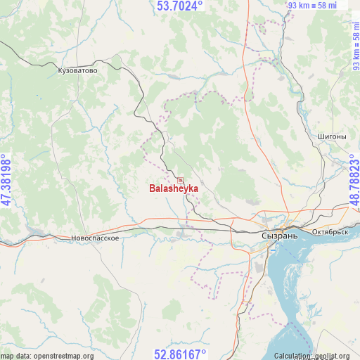
Balasheyka GPS coordinates[2]
53° 17' 2.76" North, 48° 5' 6.36" East
| Map corner | latitude | longitude |
|---|---|---|
| Upper-left | 53.7024°, | 47.38198° |
| Center: | 53.2841°, | 48.0851° |
| Lower-right: | 52.86167°, | 48.78823° |
| Map W x H: | 93.5×93.5 km | = 58.1×58.1mi |
| max Lat: | 73.50819° ⇑60.5% North |
| Balasheyka: | 53.2841° |
| min Lat: | ⇓39.5% South 41.28413° |
| min Long | Balasheyka | max Long |
| -179.12198° | 48.0851° | 179.35046° |
| W 59.1%⇐ | ⇒40.9% E |
Elevation
Elevation of Balasheyka is 169 m = 554 ft, and this is 33.6 m = 110 ft below average elevation for this country.
| Max E: |
2518 m = 8261 ft | 39.7% |
| Avg. | 202.6 m = 665 ft | |
| Balasheyka | 169 m = 554 ft | |
Min E: |
-28 m = -92 ft | 60.3% |
See also: Russia elevation on elevation.city.
Geographical zone
Balasheyka is located in North temperate zone (between Tropic of Cancer and the Arctic Circle). Distance of this North polar circle is 1476.5 km =917.5 mi to North.| Distance of | km | miles | from Balasheyka |
|---|---|---|---|
| North Pole | 4082.4 | 2536.7 | to North |
| Arctic Circle | 1476.5 | 917.5 | to North |
| Tropic Cancer | 3318.7 | 2062.1 | to South |
| Equator | 5924.6 | 3681.4 | to South |


Nearby cities:
15 places around Balasheyka: (largest is in red/bold)
• Izmaylovo
73.8 km =45.9 mi,  311°
311°
• Kanadey
39.4 km =24.5 mi,  250°
250°
• Kuzovatovo
39.4 km =24.5 mi,  317°
317°
• Mezhdurechensk
68.3 km =42.4 mi,  91°
91°
• Nikolayevka
61.3 km =38.1 mi, 253°
• Novospasskoye
27 km =16.8 mi,  235°
235°
• Obsharovka
54.1 km =33.6 mi,  109°
109°
• Oktyabr’sk
43 km =26.7 mi, 107°
• Perevoloki
72.9 km =45.3 mi, 93°
• Radishchevo
49.7 km =30.9 mi,  196°
196°
• Shigony
41 km =25.5 mi,  73°
73°
• Staraya Kulatka
69.3 km =43.1 mi,  206°
206°
• Starotimoshkino
60.7 km =37.7 mi, 322°
• Syzran’
29.1 km =18.1 mi,  118°
118°
• Varlamovo
24.8 km =15.4 mi, 115°
Sources, notices
• [Note1] Compared only with cities in Russia existing in our database
• [Src1] Map data: © OpenStreetMap contributors (CC-BY-SA)
• [Src2] Other city data from geonames.org with taken over terms of usage.
• [Src3] Geographical zone / Annual Mean Temperature by Robert A. Rohde @ Wikipedia
