Nekrasovka geodata
Nekrasovka (Moscow) is a section of populated place; located in Russia in Europe/Moscow (GMT+3) time zone. With population of 7,994 people, there are 1800 cities with bigger population in this country. Compared to other cities in Russia, 61.4% of cities are located further ↓South; 78% of cities are located further →East and 58.6% of cities have higher elevation than Nekrasovka. Note1


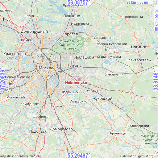
Nekrasovka GPS coordinates[2]
55° 41' 35.808" North, 37° 54' 41.328" East
| Map corner | latitude | longitude |
|---|---|---|
| Upper-left | 56.08757°, | 37.20836° |
| Center: | 55.69328°, | 37.91148° |
| Lower-right: | 55.29497°, | 38.61461° |
| Map W x H: | 88.1×88.1 km | = 54.7×54.7mi |
| max Lat: | 73.50819° ⇑38.6% North |
| Nekrasovka: | 55.69328° |
| min Lat: | ⇓61.4% South 41.28413° |
| min Long | Nekrasovka | max Long |
| -179.12198° | 37.91148° | 179.35046° |
| W 22%⇐ | ⇒78% E |
Elevation
Elevation of Nekrasovka is 127 m = 417 ft, and this is 75.6 m = 248 ft below average elevation for this country.
| Max E: |
2518 m = 8261 ft | 58.6% |
| Avg. | 202.6 m = 665 ft | |
| Nekrasovka | 127 m = 417 ft | |
Min E: |
-28 m = -92 ft | 41.4% |
See also: Russia elevation on elevation.city.
Geographical zone
Nekrasovka is located in North temperate zone (between Tropic of Cancer and the Arctic Circle). Distance of this North polar circle is 1208.7 km =751.1 mi to North.| Distance of | km | miles | from Nekrasovka |
|---|---|---|---|
| North Pole | 3814.5 | 2370.2 | to North |
| Arctic Circle | 1208.7 | 751.1 | to North |
| Tropic Cancer | 3586.6 | 2228.6 | to South |
| Equator | 6192.5 | 3847.8 | to South |


Nearby cities:
15 places around Nekrasovka: (largest is in red/bold)
• Dzerzhinskiy
7.9 km =4.9 mi,  205°
205°
• Dzerzhinsky
8.1 km =5 mi,  204°
204°
• Korenëvo
6.5 km =4 mi,  111°
111°
• Kotel’niki
7.7 km =4.8 mi, 213°
• Kraskovo
6.8 km =4.2 mi,  135°
135°
• Kuskovo
7 km =4.3 mi,  310°
310°
• Kuz’minki
7 km =4.3 mi,  276°
276°
• Lyubertsy
2.1 km =1.3 mi, 212°
• Purshevo
8.2 km =5.1 mi,  67°
67°
• Reutov
8.3 km =5.2 mi,  335°
335°
• Saltykovka
8.3 km =5.2 mi,  10°
10°
• Tomilino
4.7 km =2.9 mi,  151°
151°
• Veshnyaki
6.7 km =4.2 mi,  300°
300°
• Vykhino-Zhulebino
6.3 km =3.9 mi, 278°
• Zhulebino
3.9 km =2.4 mi, 280°
Sources, notices
• [Note1] Compared only with cities in Russia existing in our database
• [Src1] Map data: © OpenStreetMap contributors (CC-BY-SA)
• [Src2] Other city data from geonames.org with taken over terms of usage.
• [Src3] Geographical zone / Annual Mean Temperature by Robert A. Rohde @ Wikipedia
